China started four Earth observation satellites to image a dike breach that occurred in the central province of Hunan on Friday afternoon and assist in the rescue operation.
The high-resolution satellites have carried out five imaging missions and sent back five pieces of post-disaster data.
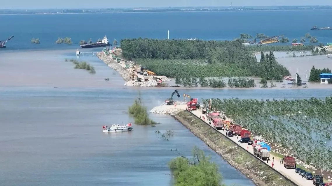
A dike of the Dongting Lake burst at 17:48 Friday following failed emergency repair efforts in Tuanzhou Township of Hunan's Yueyang City, causing flooding in the area.
The breach was about 10 meters wide on Friday afternoon, but has expanded to 226 meters as of 11:00 meters on Saturday with the water level difference reducing to 0.1 meters.
As the water level difference further reduced, rescuers started the breach-blocking operation on Saturday afternoon with heavy trucks dumping sand, gravels and boulders into the gap.
Over 5,700 residents of the affected area have been evacuated to safety, and no casualties have been reported, according to the local flood control department.
About 55,600 tons of rocks have been urgently transferred from Huarong's surrounding counties and cities to block the gap.
More than 2,300 rescuers and over 160 speedboats have been dispatched to carry out the rescue operation. Sand, gravels, rock blocks and other flood prevention materials are being transported to the scene.
Plastic sheets have been laid for 10 kilometers to reinforce a dam that separates Tuanzhou from nearby townships. Personnel were also deployed to conduct 24-hour patrol.
Dongting is China's second-largest freshwater lake. The affected area near Tuanbei Village covers about 50 square km. This area experienced a dike breach back in 1996.
Since June 16, Hunan has suffered the strongest rainfall this year, which has broken local historical records in some regions.
China starts Earth observation satellites to image dike breach in Hunan