INDIANAPOLIS (AP) — The remnants of Hurricane Beryl dropped tornadoes and threatened flooding Wednesday as the system churned into Canada and the northeastern U.S. after leaving millions in the Houston area without power.
Beryl, which landed in Texas on Monday as a Category 1 hurricane, was a post-tropical cyclone and centered over southeastern Michigan around midday Wednesday with maximum sustained winds of 30 mph (45 kph), the National Weather Service reported.
Click to Gallery
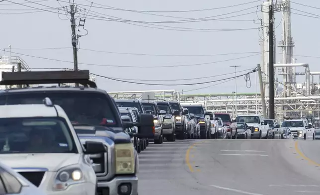
People wait in line for gas the day after Hurricane Beryl made landfall nearby Tuesday, July 9, 2024, in Freeport. (Jon Shapley/Houston Chronicle via AP)

East End residents Laura and Jose Galvan sift through perishable foods that were left outside of a Kroger due to power outages from the recent Hurricane Beryl that made landfall in Houston on Tuesday, July 9, 2024. (Raquel Natalicchio/Houston Chronicle via AP)
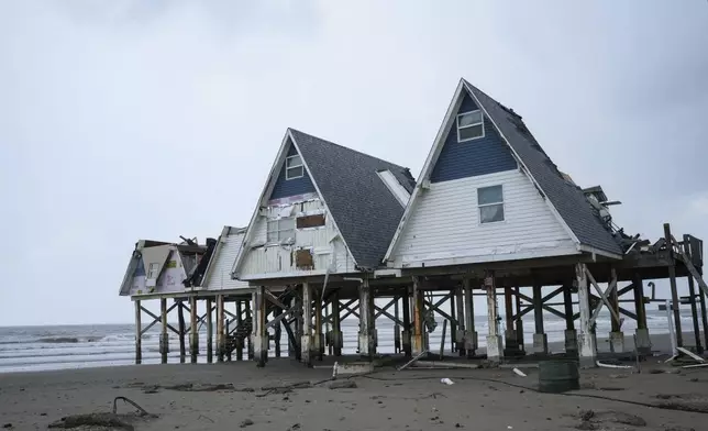
A-frame houses are seen the day after Hurricane Beryl made landfall nearby Tuesday, July 9, 2024, in Surfside Beach, Texas. (Jon Shapley/Houston Chronicle via AP)

Houston resident Ashley Doyle and her children, Kaysen and Jayce, spend time at Gallery Furniture, which is being used as a temporary shelter, to cool off and and have a meal, Tuesday, July 9, 2024, in Houston. The effects of Hurricane Beryl left most in the area without power. (AP Photo/Eric Gay)
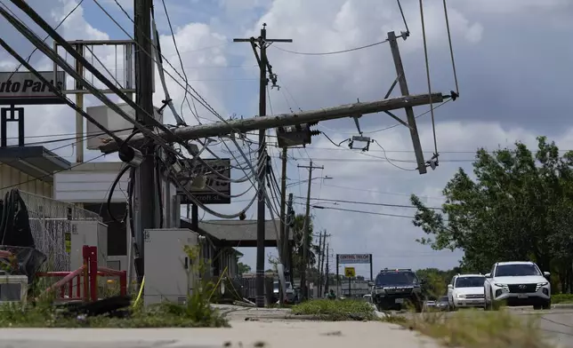
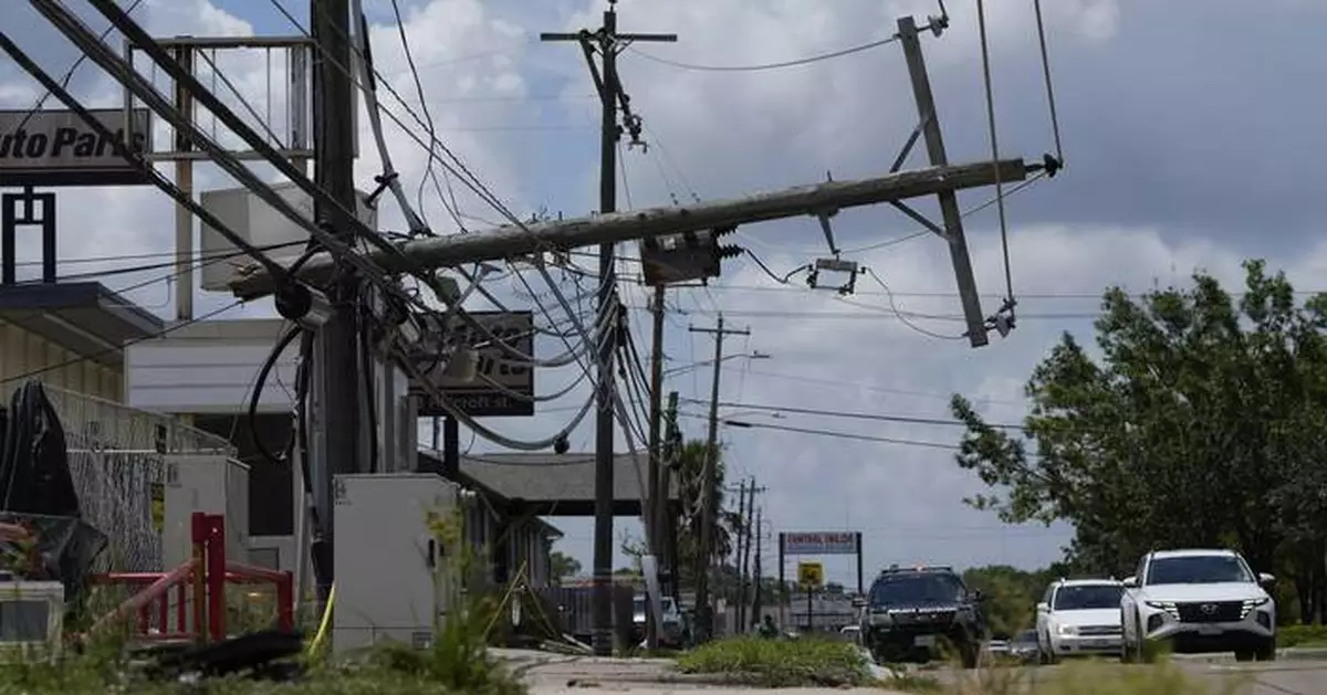
Traffic is directed around a downed power line in Houston, Tuesday, July 9, 2024. After Hurricane Beryl slammed into Texas, knocking out power to nearly 3 million homes and businesses it moved east and weakened to a tropical depression. (AP Photo/Eric Gay)
A threat of heavy rain and flooding stretched from the Great Lakes to New England and included southern Canada. The storm dumped 3 to 6 inches (7.6 to 15.2 centimeters) of rain in northern Indiana, saturating the ground and putting trees at risk of toppling in strong winds.
Tens of thousands of customers lost power in New York, Michigan and Pennsylvania, according to PowerOutage.us.
At least one tornado touched down Wednesday afternoon in upstate New York, the weather service reported. Videos posted to social media showed swirling debris under ominous skies. It damaged trees and property in communities south of Buffalo, said Erie County Executive Mark Poloncarz. There were no reports of injuries.
In adjacent Vermont, there was sporadic flash flooding on the anniversary of severe floods last July. The weather service said the storm “will not be like last July’s catastrophic flooding but will still pose real dangers where flash flooding occurs."
In a Wednesday night update, Vermont Emergency Management said there had been an unspecified number of evacuations and road closures due to flooding, primarily in the central part of the state.
“Vermonters and visitors are encouraged to seek higher ground should floodwaters approach,” the statement said.
Rescue teams and the National Guard were at the ready, the agency said.
A tornado Tuesday evening in southwestern Indiana's Posey County collapsed much of a warehouse and ripped off roofs, derailed train cars, and damaged mobile homes. No injuries were reported.
Jerrod Prather, a supervisor for Nutrien Ag Solutions, told the Evansville Courier & Press that he watched the tornado on a security camera.
“I saw it come down and kind of lift back up, and then come down again,” he said.
Beryl has been blamed for at least seven U.S. deaths — one in Louisiana and six in Texas — and at least 11 in the Caribbean. More than 1.6 million homes and businesses in Texas still lacked electricity early Wednesday afternoon, down from a peak of over 2.7 million on Monday, according to PowerOutage.us.
Contributing to this report were Associated Press writers Sarah Brumfield in Maryland, Carolyn Thompson in upstate New York, and Lisa Rathke in Vermont.
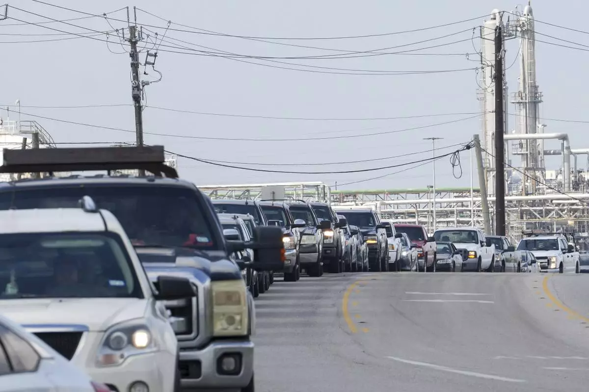
People wait in line for gas the day after Hurricane Beryl made landfall nearby Tuesday, July 9, 2024, in Freeport. (Jon Shapley/Houston Chronicle via AP)

East End residents Laura and Jose Galvan sift through perishable foods that were left outside of a Kroger due to power outages from the recent Hurricane Beryl that made landfall in Houston on Tuesday, July 9, 2024. (Raquel Natalicchio/Houston Chronicle via AP)
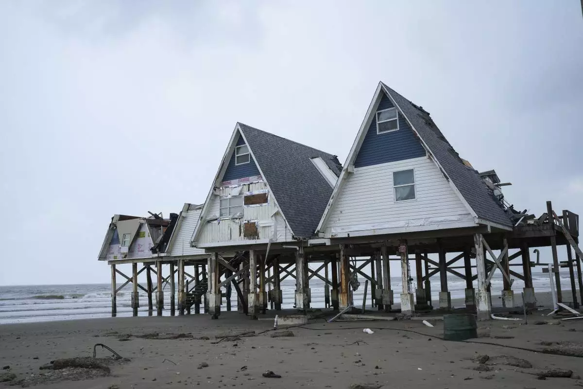
A-frame houses are seen the day after Hurricane Beryl made landfall nearby Tuesday, July 9, 2024, in Surfside Beach, Texas. (Jon Shapley/Houston Chronicle via AP)

Houston resident Ashley Doyle and her children, Kaysen and Jayce, spend time at Gallery Furniture, which is being used as a temporary shelter, to cool off and and have a meal, Tuesday, July 9, 2024, in Houston. The effects of Hurricane Beryl left most in the area without power. (AP Photo/Eric Gay)
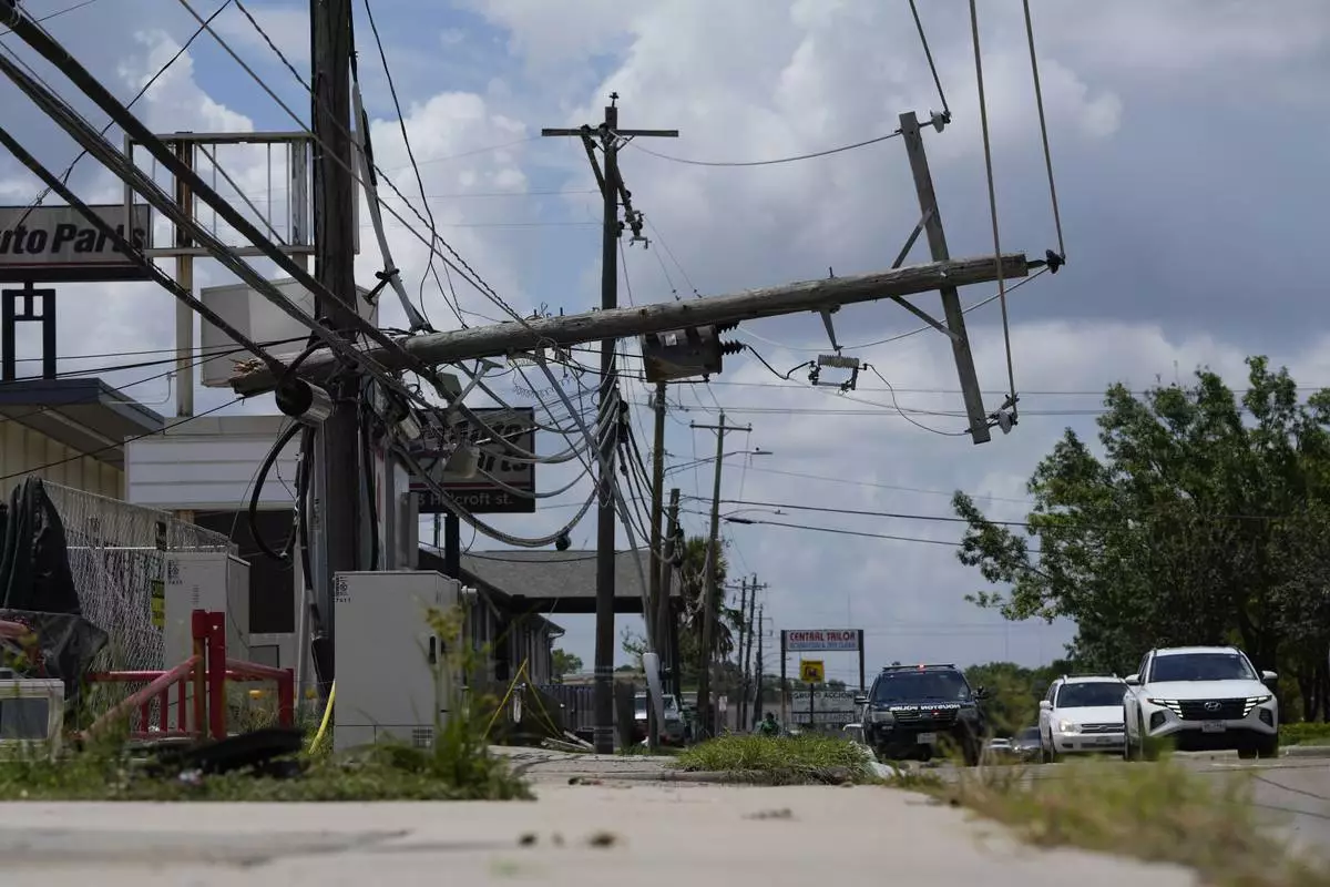
Traffic is directed around a downed power line in Houston, Tuesday, July 9, 2024. After Hurricane Beryl slammed into Texas, knocking out power to nearly 3 million homes and businesses it moved east and weakened to a tropical depression. (AP Photo/Eric Gay)