MIAMI GARDENS, Fla. (AP) — The Miami Dolphins will bring in another quarterback while starter Tua Tagovailoa deals with his latest concussion, and coach Mike McDaniel insisted Friday that the only thing that should matter to him — or anyone — is Tagovailoa's health.
For the short term at least, Skylar Thompson will be considered the Dolphins' starter while Tagovailoa is sidelined. Tagovailoa left Thursday night's 31-10 loss to Buffalo in the third quarter with the third known concussion of his NFL career, all of them coming in the last 24 months.
Click to Gallery
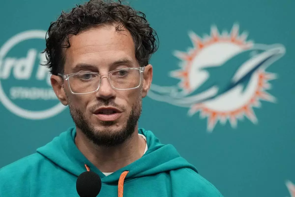
Miami Dolphins head coach Mike McDaniel talks during a news conference following an NFL football game against the Buffalo Bills, Friday, Sept. 13, 2024, in Miami Gardens, Fla. (AP Photo/Rebecca Blackwell)
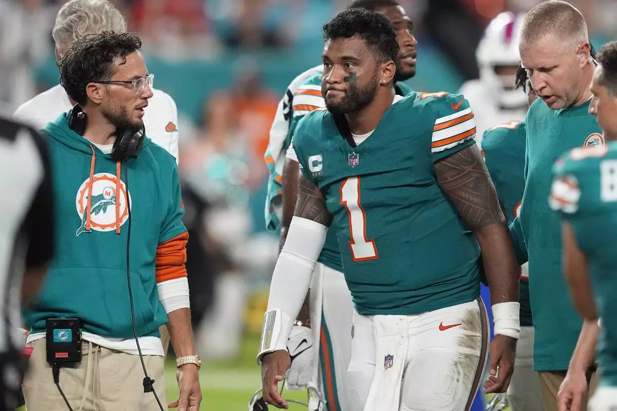
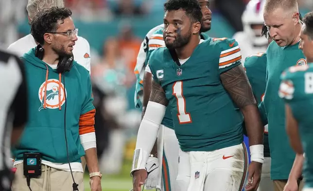
Miami Dolphins head coach Mike McDaniel talks to quarterback Tua Tagovailoa (1) as he leaves the game after suffering a concussion during the second half of an NFL football game against the Buffalo Bills, Thursday, Sept. 12, 2024, in Miami Gardens, Fla. (AP Photo/Rebecca Blackwell)
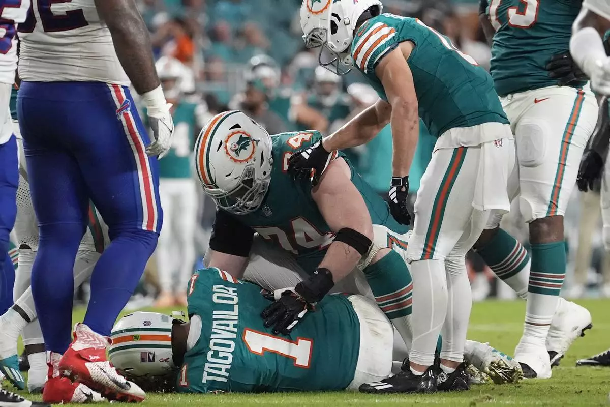
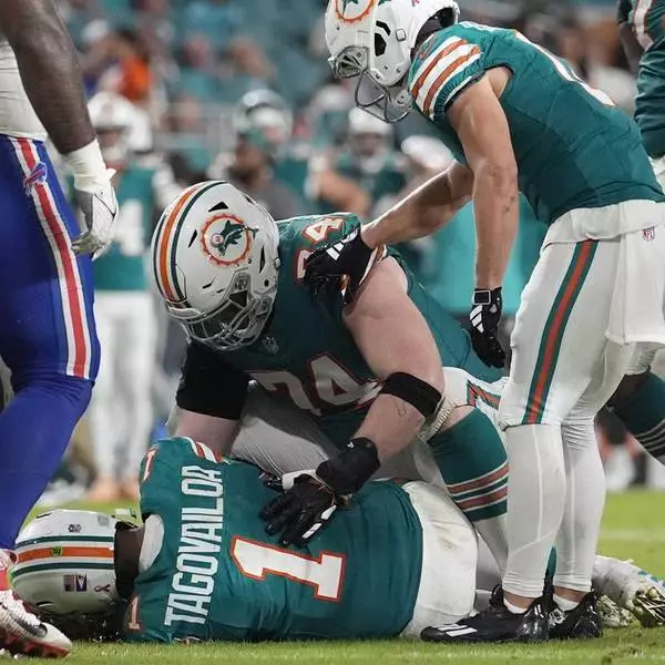
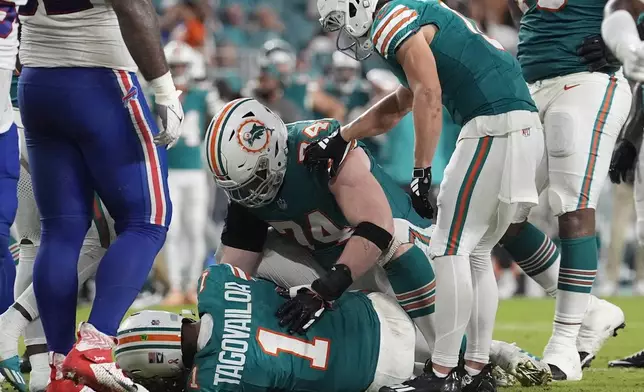
Miami Dolphins quarterback Tua Tagovailoa (1) lies on the field after suffering a concussion during the second half of an NFL football game against the Buffalo Bills, Thursday, Sept. 12, 2024, in Miami Gardens, Fla. (AP Photo/Lynne Sladky)
Dolphins will bring in another quarterback, while Tagovailoa deals with concussion
Dolphins will bring in another quarterback, while Tagovailoa deals with concussion
“The team and the organization are very confident in Skylar,” McDaniel said.
McDaniel said the team has not made any decision about whether to place Tagovailoa on injured reserve. Tagovailoa was at the team facility Friday, as expected and as McDaniel said would be the case, to start the process of being evaluated in earnest.
How long that process takes is one of the countless unknowns right now.
“The people that matter most, and their opinions, are Tua, the doctors and the experts,” McDaniel said.
McDaniel and Tagovailoa have expressed often over their time together that their relationship is close. And McDaniel tried to make clear multiple times Friday that his top priority is Tagovailoa's well-being — not when he plays again.
“All the science behind concussions tells you what we’ve learned is how delicate the time is right after an injury and how important it is that you don’t institute extra sources of anxiety,” McDaniel said. “So, from my vantage point, I feel it’s supremely important in understanding that, that I’m not giving off any sort of vibes.”
There are a slew of veteran quarterbacks available for the Dolphins to consider, including Jimmy Garoppolo and former Miami starter Ryan Tannehill. The Dolphins have not revealed any players who are under consideration, and — despite plenty of former players suggesting it may be time for Tagovailoa to consider his long-term health — McDaniel said it would be “so wrong” for him to even think about weighing in on whether the quarterback should play again.
“I wish people would for a second hear what I’m saying, that bringing up his future is not in the best interest of him,” McDaniel said. "So, I’m going to plead with everybody that does genuinely care — that should be the last thing on your mind.”
Concerns and opinions from around the football world were coming nonstop Friday, from former Alabama coach Nick Saban — Tagovailoa's college coach — urging the quarterback and his family to proceed with caution, to Las Vegas Raiders coach Antonio Pierce saying he would tell Tagovailoa to stop playing the game.
“I’ll be honest: I’d just tell him to retire," Pierce said.
All that seems certain: McDaniel doesn't envision Tagovailoa playing in Miami's next game at Seattle on Sept. 22.
Tagovailoa was hurt on a play where he collided into Bills defensive back Damar Hamlin. Tagovailoa, who was rushing successfully for a first down, initiated the contact by lowering his shoulder into Hamlin instead of sliding as many quarterbacks do on a scramble.
Players from both teams motioned that Tagovailoa was hurt after that play, and as he lay on the turf the quarterback exhibited some signs — certain arm movements, for example — typically associated with a traumatic brain injury. He remained down on the field for a couple of minutes, got to his feet and walked to the sideline after the play in the third quarter.
McDaniel gave his quarterback a kiss on the side of the head as he left the field Thursday. McDaniel revealed Friday that, in that moment, he was telling Tagovailoa to focus on what matters most — his health and his family.
“All I'm telling Tua is everyone is counting on you to be a dad and be a dad this weekend," McDaniel said. “And then we'll move from there.”
There are five steps, as mandated by the NFL concussion protocol, that Tagovailoa will have to clear before he can return to the field. That process can take days or even weeks.
Tagovailoa was 17 for 25 passing for 145 yards, with one touchdown and three interceptions — one of which was returned for a Buffalo score — when he got hurt. Thompson completed eight of 14 passes for 80 yards.
“We’re just evaluating the pros and cons for the different situations and getting through all those possibilities to do the best thing for the team,” McDaniel said, when revealing that the team had already decided to bring in another quarterback. "But as it stands today, I’m expecting that Skylar is the next man up.”
Thompson said he feels “fully equipped” to run the Dolphins' offense.
“What’s going to lie ahead, who knows, but man, I’m confident, though,” Thompson said after Thursday's game. “I feel like I’m ready for whatever’s to come. I’m going to prepare and work hard and do everything I can to lead this team and do my job.”
AP NFL: http://www.apnews.com/hub/NFL

Miami Dolphins head coach Mike McDaniel talks during a news conference following an NFL football game against the Buffalo Bills, Friday, Sept. 13, 2024, in Miami Gardens, Fla. (AP Photo/Rebecca Blackwell)

Miami Dolphins head coach Mike McDaniel talks to quarterback Tua Tagovailoa (1) as he leaves the game after suffering a concussion during the second half of an NFL football game against the Buffalo Bills, Thursday, Sept. 12, 2024, in Miami Gardens, Fla. (AP Photo/Rebecca Blackwell)

Miami Dolphins quarterback Tua Tagovailoa (1) lies on the field after suffering a concussion during the second half of an NFL football game against the Buffalo Bills, Thursday, Sept. 12, 2024, in Miami Gardens, Fla. (AP Photo/Lynne Sladky)

Dolphins will bring in another quarterback, while Tagovailoa deals with concussion

Dolphins will bring in another quarterback, while Tagovailoa deals with concussion
The Hamas militant group released the last living American-Israeli hostage held in Gaza on Monday as an Israeli strike on a school-turned-shelter in the Gaza Strip killed about 16 people in the embattled enclave, mostly women and children.
Hamas said it released Edan Alexander as a goodwill gesture toward the Trump administration to try to revive talks on ending the war. The Israeli military said Alexander was with the Red Cross and is now with Israeli forces, and had crossed into Israeli territory.
The release and the attack came as U.S. President Donald Trump heads to Saudi Arabia, Qatar and the United Arab Emirates this week.
After ending a ceasefire two months ago, Israel has intensified the war in the Gaza Strip, where its 10-week blockade on food, medicine and other supplies is worsening a humanitarian crisis.
Here is the latest:
The U.N. peacekeeping mission in southern Lebanon reports that armed activities by Israeli forces north of the Blue Line – the U.N. drawn boundary – violate a Security Council resolution that ended the 2006 Israel-Hezbollah war.
U.N. spokesman Stephane Dujarric said in the latest incident a peacekeeping patrol reported that 10 Israeli soldiers crossed north of the Blue Line on Monday near Alma al-Shaab.
Dujarric said peacekeepers from the U.N. force known as UNIFIL also continue to discover unauthorized weapons and ammunition caches.
On Friday, he said, they found a suspected rocket launching site near the village of Kfar Hammam and reported it to the Lebanese army.
Since November’s cessation of hostilities between Israel and Hezbollah militants, peacekeepers have detected about 240 sites with unauthorized weapons and ammunition, Dujarric said.
Asked by reporters about U.S. sidelining Israel, Danon said Monday that while the two countries remain strong, longtime allies, there have been recent instances where the two countries’ interests have not been “aligned.”
The remarks were in response to an apparent rift between President Donald Trump and Israeli Prime Minister Benjamin Netanyahu, who has been increasingly bypassed in recent weeks as the U.S. has proposed or brokered deals with a number of regional players, including Houthi rebels in Yemen and Iran, without consultation with Israel.
“We are partners and allies, but we are two independent countries,” Danon told reporters at the UN in New York. He added that while it is “legitimate for the U.S. to do what they think is good for the US,” it is also “legitimate for Israel to take action on things that are necessary to protect Israel.”
On Monday, a statement from Netanyahu’s office said Israel would carry on with plans to ramp up its offensive in Gaza, but it won’t launch that plan until after Trump’s visit to the Middle East, to allow for a potential new ceasefire deal to emerge.
Israeli Ambassador to the U.N. Danny Danon confirmed to reporters Monday that Israel will be holding off the start of their operation in Gaza for a few days.
“Israel is preparing a major operation in Gaza, we are not hiding it. We have called up the reserves, and we have the troops ready. And if there will be no development in the negotiations, we will apply pressure, military pressure, in order to make sure that we bring back the hostages and then eliminate Hamas," Danon said. “It can be avoided ... if the framework that Ambassador Witkoff proposed will be accepted.”
Secretary-General Antonio Guterres is also alarmed that Gaza’s entire population is facing the risk of famine, and is especially alarmed that the vast majority of children are facing “extreme food deprivation,” U.N. spokesman Stephane Dujarric said Monday.
The dire report on hunger in Gaza released earlier Monday by the Integrated Food Security Phase Classification System shows that Israel’s 70-day ban on the entry of food and other supplies is “a human made catastrophe that the world should now allow,” Guterres’ spokesman said.
The U.N. and the secretary-general have repeatedly called on Israel to immediately open the border crossings and allow 116,000 metric tons of food assistance waiting on the other side to be delivered, Dujarric said, adding that this could feed one million people for four months
Secretary-General Antonio Guterres urges Israel and Hamas to build on his release and reach an immediate permanent ceasefire in Gaza that will ensure the unconditional release of all hostages, U.N. spokesman Stephane Dujarric said Monday.
He commends efforts by the mediators – Egypt, Qatar and the United States – to bring an end to the war in Gaza that followed Hamas’ surprise attack in southern Israel on Oct. 7, 2023, Dujarric said.
Guterres also calls on all parties to ensure the rapid delivery of humanitarian aid, which is “not negotiable,” the spokesman said.
“I feel like I can finally breathe," said Agam Shalam, who went to high school and trained for the Israeli army in a unit with Alexander.
She recalled being on a kibbutz in southern Israel when Hamas attacked on Oct. 7, 2023, hiding in bomb shelters and hearing after a couple days that an Israeli military officer had contacted Alexander’s parents to say that he had been taken hostage.
She called it as “an insane thing to hear, for the first time. I don’t think anyone ever, I never expected for my friend to be held hostage, not for a stay, not for a week and certainly not for 580 days.”
There was no official comment from PA.
The PA imposed a ban on Al Jazeera in January, accusing it of incitement. The move came after Al Jazeera covered a rare crackdown on West Bank militants led by the PA’s security forces.
Israel banned Al Jazeera last year, accusing it of incitement and of serving as a mouthpiece of Hamas.
Al Jazeera has denied the allegations and accused both Israel and the PA of trying to silence critical coverage.
The PA exercises limited autonomy in parts of the Israeli-occupied West Bank.
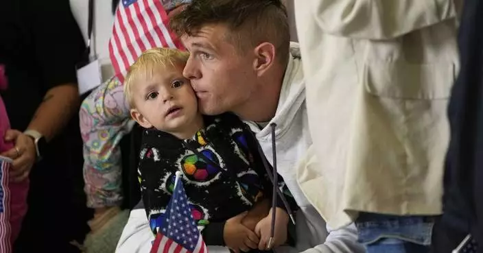
Hundreds of supporters packed the streets of the 21-year-old Alexander's hometown, hugging, jumping and swaying to Israeli music blasting on speakers. They cheered the news of his release while watching a live news broadcast from Israel on a large videoscreen.
Shirly Zaifman, whose children went to school with Alexander, said his family is an important part of the town.
“People are here for him because he brings people together,” Zaifman said.
Carley Peven, of Teaneck, N.J. said “we are overjoyed, we could use some good news while we still have 58 other hostages, we’re going to take this moment to celebrate.”
Her heart, she said, is “overflowing. We’ve been fighting for this for over 500 days.”
The Israeli military says a hostage released in the Gaza Strip, Edan Alexander, was with the Red Cross and is now with Israeli forces.
Alexander was taken from his military base in southern Israel during Hamas’ cross-border attack on Oct. 7, 2023, which set off the war in Gaza. His release would be the first since Israel shattered an eight-week ceasefire with Hamas in March, unleashing fierce strikes on Gaza that have killed hundreds.
Hamas says it has released Israeli-American hostage Edan Alexander as a goodwill gesture toward the Trump administration to try to revive talks on ending the war.
There was no immediate confirmation from Israel.
The release comes ahead of President Donald Trump’s visit to the Middle East this week.
In Edan Alexander’s hometown of Tenafly, New Jersey people gathered in the streets around Huyler Park with yellow “welcome home” and “bring them home” signs and set up a large video screen with a live newsfeed from Israel. Supporters have gathered every Friday to march for the hostages’ release.
Shirly Zaifman, whose children went to school with Alexander, said the 21-year-old is funny, smart and athletic, and that his family is an important part of the town.
“We’re ecstatic, we’re nervous just because we know, you know, anything can happen last minute,” Zaifman said, draped in an American and Israel flag. “We’re hoping for the best, it looks like it’s happening, but it’s such a thrill.”
“We may want to take them off of Syria, because we want to give them a fresh start,” said Trump, adding that Turkish President Recep Tayyip Erdogan has urged him to do so.
The comments were striking change in tone from the president on Syria sanctions and the government of Syrian President Ahmed Al-Sharaa.
Al-Sharaa took power after his Islamist group, Hayat Tahrir al-Sham (HTS), led an offensive that toppled former President Bashar Assad in December.
The Trump administration has yet to formally recognize the new Syrian government led by Ahmed al-Sharaa, and HTS remains a U.S.-designated terrorist organization. Sanctions imposed on Damascus under Assad also remain in place.
Hawks in the White House and the Republican Party have been skeptical of al-Sharaa’s transformation and insist Syria remains a counter-terrorism issue.
Trump said that the U.S.-Israeli citizen was expected to be released by Hamas in the “next two hours” or “sometime today.”
“He’s coming home to his parents, which is really great news,” Trump told reporters at the White House shortly he was scheduled to depart for a whirlwind visit to Saudi Arabia, Qatar and United Arab Emirates.
Trump credited his special envoy Steve Witkoff in helping win the release of Alexander, 21.
The president said that Witkoff, a New York real estate developer turned diplomat, knew “very little about the subject matter” but learned quickly.
“He has a special way about him,” Trump said of Witkoff.
An Israeli official says Hamas is expected to release Edan Alexander at around 6:30 p.m. (1530 GMT).
The official spoke on condition of anonymity as they weren't authorized to brief the media
A senior United Nations official said Monday’s hunger report in Gaza is “extremely concerning” given that the strip’s roughly 2 million population continues to face “a very critical risk of famine.”
Beth Bechdol, deputy director of the U.N.’s Food and Agriculture Organization, said Gaza’s food system has collapsed since Israel reimposed its blockade.
“We are moving into a period where the entire population of the Gaza Strip … are continuing to face a very critical risk of famine and extreme hunger and malnutrition,” she said in an interview.
Mahmoud Alsaqqa, food security coordinator for the charity Oxfam, meanwhile, slammed Israel’s blockade, saying that thousands of aid trucks carrying aid were prevented from reaching desperate civilians.
“Gaza’s starvation is not incidental—it is deliberate, entirely engineered,” he said. “ It is unconscionable and is being allowed to happen.”
Dani Miran, the father of hostage Omri Miran, said he was happy for Edan Alexander’s expected release but “very sad that families of hostages need foreign passports to release their loved ones.” He said, “Does this country not know how to protect our citizens?”
Other relatives also expressed frustration over Israel’s failure to secure the release of their loved ones.
“We do not trust our government,” said Yehuda Cohen, father of hostage Nimrod Cohen. “We need you, we need the United States, we need President Trump, we need special envoy Steve Witkoff to finish the job and free all the hostages.”
Einav Zangauker said her son, Matan, was held together with Edan Alexander and her “heart breaks from the knowledge that he will languish alone in captivity.”
Addressing Trump in English, she said, “Mr. President, sir, all of the Israeli people are behind you. End this war! Bring them all home!”
Food security experts said on Monday the Gaza Strip is at critical risk of famine if Israel doesn’t lift its blockade and stop its military campaign.
Integrated Food Security Phase Classification, a leading international authority on the severity of hunger crises, said outright famine is the most likely scenario unless conditions change.
Nearly half a million Palestinians are in “catastrophic” levels of hunger, meaning they face possible starvation, the report said, while another million are at “emergency” levels of hunger.
The Palestinian Health Ministry also said Monday hospitals received 94 wounded. The dead included four bodies that were recovered from under the rubble, it said.
The death toll from the Israel-Hamas war has now reached 52,862, the ministry said, while 119,648 have been wounded.
It said the tally includes 2,749 dead and 7,607 wounded since Israel resumed the war in March, shattering a nearly 2-month ceasefire.
The ministry does not differentiate between civilians and combatants, but says more than half of the dead were women and children.
Israel has filed a request with the International Criminal Court to have arrest warrants for Israeli Prime Minister Benjamin Netanyahu and his former defense minister, Yoav Gallant, revoked after an appeal last month ordered a pretrial panel to reconsider jurisdiction but did not suspend the warrants.
In a filing made public over the weekend.
Israel says the court did not have the legal authority to issue arrest warrants in November.
The warrants allege that Netanyahu and Gallant are responsible for crimes against humanity in the Gaza war. Israel, which is not a member of the court and rejects its jurisdiction, strongly refutes the allegations.
Hamas says it will release Edan Alexander on Monday.
Alexander, an Israeli soldier, was taken captive on Oct. 7, 2023.
Edan Alexander’s family said in a statement that it “received the greatest gift imaginable — news that our beautiful son Edan is returning home after 583 days in captivity in Gaza.”
Alexander’s parents, who live in the United States, were making their way to Israel ahead of the expected release.
The family said it was deeply grateful to Trump and his administration for their efforts to secure Edan's release.
It also urged the Israeli government to continue efforts to free all the hostages. “Please don’t stop. We hope our son’s release begins negotiations for all 58 remaining hostages, ending this nightmare for them and their families.”
The relatives of Israeli hostages welcomed the imminent release of the American-Israeli hostage, but there is also unease.
Some said Alexander was singled out for freedom because of his American citizenship and said they were worried about the fate of the other 23 living and roughly 35 dead captives who remain in Gaza.
“Trump is rescuing him. Who will rescue Gali and Ziv?” Maccabit Mayer, the aunt of sibling hostages Gali and Ziv Berman, told Israeli Army Radio on Monday. She said she was sorry the twin brothers don't have “the right citizenship.”
Also, some of the relatives accuse Prime Minister Benjamin Netanyahu of not doing enough to free their loved ones, saying his insistence on continuing the war in Gaza is politically motivated.
Hamas says the last living American hostage in Gaza will be released as part of efforts to establish a ceasefire, reopen crossings into the Israeli-blockaded territory and resume aid delivery to the battered enclave.
Two Hamas officials have told The Associated Press they expect the release of Edan Alexander in the next 48 hours.
Trump’s envoy Steve Witkoff confirmed in a message to the AP that Hamas has agreed to release Alexander as a goodwill gesture toward Trump.
Alexander is an Israeli-American soldier who grew up in the United States.
Hospital patients are among the most vulnerable as Palestinians across Gaza struggle to feed themselves.
Israel’s blockade on food and other supplies entering the territory is now in its third month and hospitals are unable to provide food. Families must bring whatever they can find to help loved ones recover and doctors say patients have lost weight in recent weeks.
Aid groups say malnutrition is on the rise across Gaza. Food distributions have ended and charity kitchens are rapidly closing. Markets are empty of almost everything but canned goods and small amounts of vegetables, and prices have been rising.

A Palestinian girl struggles to obtain donated food at a community kitchen in Khan Younis, in the southern Gaza Strip, Friday, May 9, 2025. (AP Photo/Abdel Kareem Hana)

Ward Nar, left, reacts as she speaks with the photographer after returning empty-handed from attempting to receive donated food for her family, including her husband Mohammed Zaharna (center right) and their children, Sally (right) and Raed, at a community kitchen in Khan Younis, in the southern Gaza Strip, Friday, May 9, 2025. (AP Photo/Abdel Kareem Hana)

Palestinians struggle to obtain donated food at a community kitchen in Khan Younis, in the southern Gaza Strip, Friday, May 9, 2025. (AP Photo/Abdel Kareem Hana)
