The last time the eye of a major storm like Hurricane Milton struck Tampa Bay, in 1921, the city was a sleepy backwater of a few hundred thousand people. A century later, it's among the fastest-growing metropolises in the United States, with more than 3 million people, and highly vulnerable to flooding due to climate change. As Milton barrels toward the Gulf Coast of Florida, strengthening Monday into a Category 5 storm, experts are worried that a century of luck could come to a sudden end.
Here's what to know:
The National Hurricane Center is predicting storm surge in Tampa Bay and surrounding waters of between 8 and 12 feet (2.5 to 3 meters) above normal tide conditions, and rainfall of between 4 and 6 inches (10 to 15 centimeters) because of Hurricane Milton.
The entire Gulf Coast of Florida is especially vulnerable to storm surge. Last week, Hurricane Helene, which came ashore some 150 miles (240 kilometers) away from Tampa in the Florida Panhandle, still managed to cause drowning deaths in the Tampa area due to surges of around 5 to 8 feet (1.5 to 2.5 meters) above normal tide levels.
“Had it made landfall just little farther to the south and east, it could have been a lot, lot worse,” said Philip Klotzbach, a hurricane researcher at Colorado State University.
The heightened risk is partially a result of topography. The Gulf of Mexico coastline of Florida is shallow with a gentle, sloping shelf. The higher ocean floor acts as a barrier that retains the storm's outflow of water, forcing the ocean to surge onto shore. That’s the opposite of Florida’s east coast, where the ocean floor drops suddenly a few miles from the coast.
“You can have the same storm, the same intensity, the same everything, but very different surges,” said Klotzbach.
A 2015 report from the Boston-based catastrophe modeling firm Karen Clark and Co. concluded that Tampa Bay is the most vulnerable place in the U.S. to storm surge flooding from a hurricane and stands to lose $175 billion in damage.
While Floridians are no strangers to storms, Tampa hasn't been in the direct path of a major hurricane in over a century.
In that lapse, the area has exploded in growth. Tens of thousands of Americans moved to the area during the COVID-19 pandemic, with many choosing to settle along barrier islands near Clearwater and St. Petersburg overlooking the normally placid, emerald Gulf waters. More than 51,000 people moved to the area between 2022 and 2023, making it the fifth-largest-growing U.S. metropolitan area, according to U.S. Census data.
Longer term residents, after having experienced numerous false alarms and near misses like Irma in 2017, may be similarly unprepared for a direct hit. A local legend has it that blessings from Native Americans who once called the region home and used to build mounds to keep out invaders have largely protected the area from major storms for centuries.
MIT meteorology professor Kerry Emanuel said a hurricane in Tampa is the “black swan” worst-case scenario that experts have worried about for years.
“It’s a huge population. It’s very exposed, very inexperienced and that’s a losing proposition,” Emanuel, who has studied hurricanes for 40 years, said. “I always thought Tampa would be the city to worry about most.”
This item has been updated to remove erroneous information about barrier islands.
Also lurking in the waves and wind are the effects of climate change. Rising temperatures from greenhouse gas emissions have warmed the oceans, led to sea level rise and added moisture to the air — all key factors determining a hurricane's strength and the potential flooding it can cause.
“Due to global warming, global climate models predict hurricanes will likely cause more intense rainfall and have an increased coastal flood risk due to higher storm surge caused by rising seas,” Angela Colbert, a scientist at NASA’s Jet Propulsion Laboratory, wrote in a 2022 report.
On Monday, the National Hurricane Center upgraded Milton to a Category 5 storm after it gained 75 mph (120 kph) of intensity in the last 24 hours. One reason may be especially high water temperatures, which act like fuel for the storm.
“Milton’s rapid intensification is incredible,” University of Miami hurricane researcher Brian McNoldy said in an email. “I’ve been pointing out for months, the Gulf has been and is record or near-record warm.”
The researcher noted that, due to rising sea levels brought on by climate change, Hurricane Andrew’s storm surge today would be 7 inches (17 centimeters) higher than it was when that storm pounded South Florida 30 years ago.
Officials in the area began issuing evacuation orders Monday for residents in six counties surrounding Tampa Bay that are home to almost 4 million people. Residents of mobile homes, RVs and manufactured homes not capable of withstanding winds of up to 110 mph (177 kph) are especially at risk.
Florida Division of Emergency Management Director Kevin Guthrie strongly urged people to leave coastal areas, noting people who died on barrier islands during Hurricane Ian in 2022 would still be alive if they just crossed the bridge to the mainland and found shelter.
“Please, if you’re in the Tampa Bay area, you need to evacuate. If they have called an evacuation order, I beg you, I implore you to evacuate. Drowning deaths due to storm surge are 100% preventable if you leave,” Guthrie said.
Almost inexplicably, storms seem to bypass Tampa, with most Gulf disturbances passing well north of the city. The last time the Tampa area was hit by the eye of a major hurricane was Oct. 25, 1921. The hurricane had no official name but is known locally as the Tarpon Springs storm, for the seaside town where it came ashore.
The storm surge from that hurricane, estimated at Category 3 with winds of up to 129 mph (207 kph) was pegged at 11 feet (3.3 meters). At least eight people died, and damage was estimated at $5 million at the time.
Now, the tourist-friendly area known for its sandy white beaches has grown by leaps and bound, with an economy estimated to be worth nearly $200 billion. Hurricane Milton threatens to wash away all of that development.
The ‘Are residents ready?’ item has been updated to remove erroneous information about barrier islands.
AP Writers Joshua Goodman in Miami and Seth Borenstein in Washington contributed to this report.
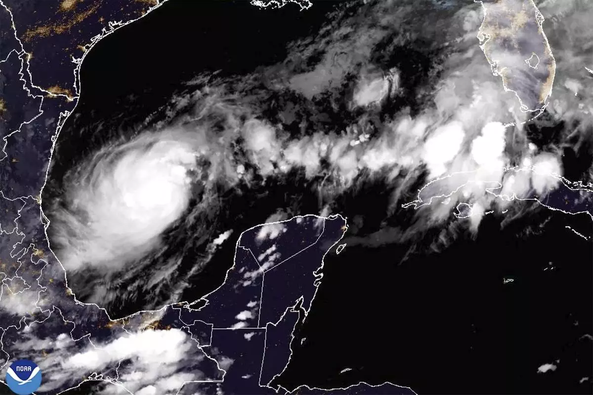
This satellite image from the National Oceanic and Atmospheric Administration taken at 7:41pm ET on Sunday, Oct. 6, 2024, shows Hurricane Milton, which quickly intensified Sunday and is on track to become a major hurricane with the Tampa Bay, Fla., area in its sights. (NOAA via AP)
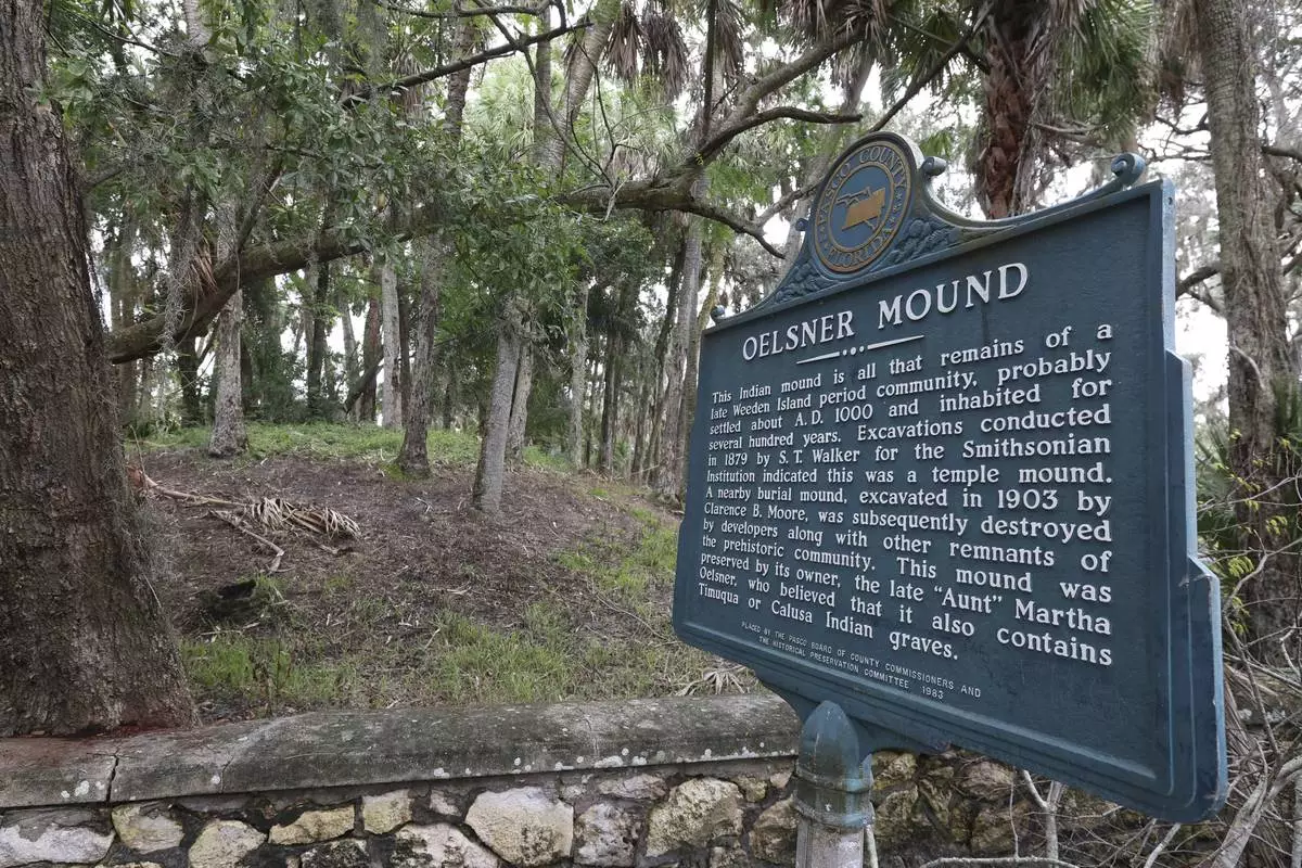
A view of the Oelsner Indian Mound in preparation for Hurricane Milton on Monday, Oct. 7, 2024, in Port Richey, Fla. Local legend in the Tampa area is that Indian mounds help steer hurricanes away from the area. (AP Photo/Mike Carlson)
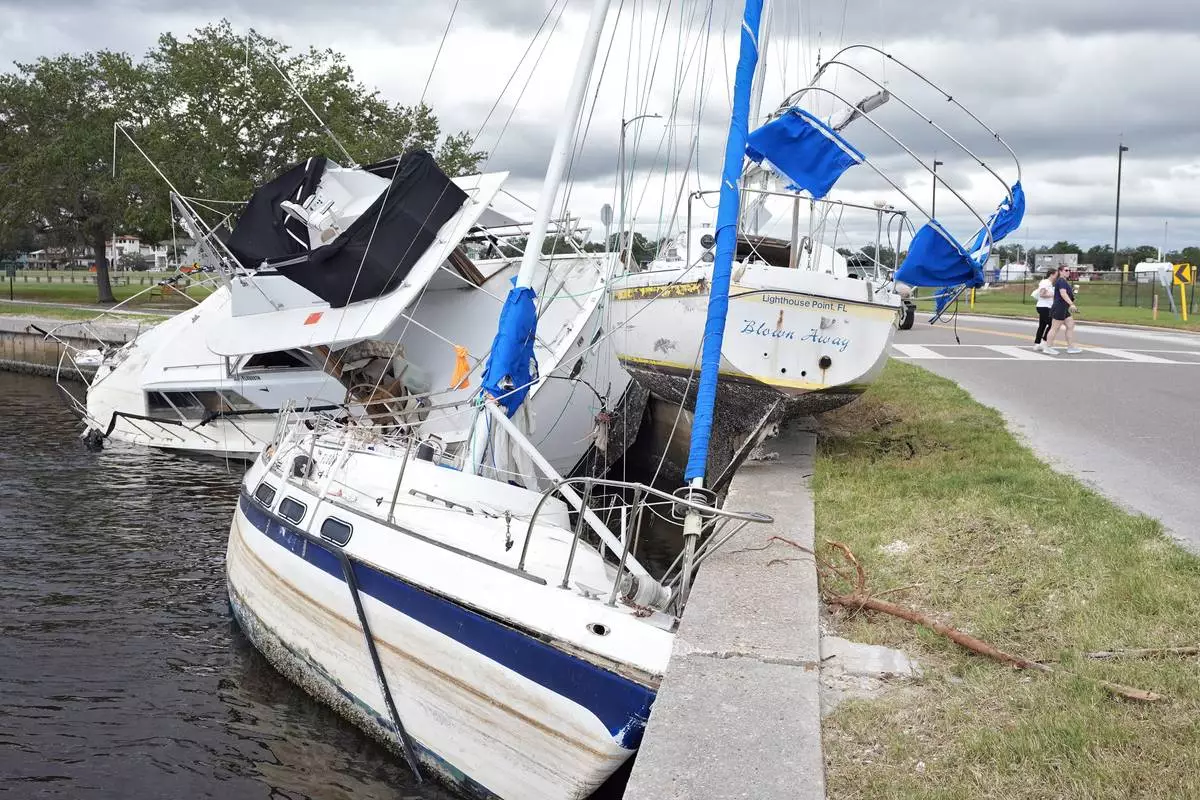
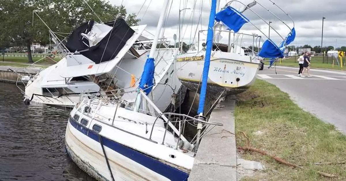
Boats destroyed during Hurricane Helene are shown on the Davis Islands Yacht Basin ahead of the possible arrival of Hurricane Milton Monday, Oct. 7, 2024, in Tampa, Fla. (AP Photo/Chris O'Meara)