Hurricane Milton dropped to a Category 4 early Wednesday as it churns toward Florida's west coast. The National Hurricane Center had predicted it would likely weaken, but remain a major hurricane when it makes landfall late Wednesday or early Thursday.
The Tampa Bay area, home to more than 3.3 million people, faced the possibility of widespread destruction after avoiding direct hits from major hurricanes for more than a century.
Follow AP’s coverage of tropical weather at https://apnews.com/hub/hurricanes.
Here’s the latest:
Shortly before noon Wednesday, officials in Pasco County, home to more than 500,000 people in bedroom communities for Tampa and St. Petersburg, said they were getting ready to take buses off the roads.
“This is your last chance if you need to get to a shelter,” the Pasco County Public Information Office said in a written statement. “After that, you’ll need to find a way to the shelter or be prepared to ride out the storm.”
The county has six shelters open for anyone in mandatory evacuation zones.
Foretasted tornadoes and up to 18 inches (46 centimeters) of rain — along with possible hurricane-force wind — prompted officials in the storm’s path in central Florida to urge people to reach their safe places immediately.
“Go now. Don’t wait. The time to be able to move around safely and make those last minute preparations is rapidly closing,” Polk County Emergency Management Director Paul Womble urged residents in a public briefing Wednesday morning.
Inland from the Tampa area and south of Orlando, Polk County is home to the Legoland Florida Resort theme park, which was closed ahead of the storm.
The weather will get bad after dark and flooding may even worsen over the next couple days as rainwater finds its way to the ocean, Womble warned.
“Once you’re hunkered down, just stay put. There’s no reason at that point to go out there. There will be trees down, there will be power lines down, it will be dangerous to move around,” Womble said.
Nearly 3,000 people already were in the county’s 19 shelters and there was still plenty of space for more, he said.
“Those evacuating before Hurricane Milton or recovering from Hurricane Helene should not be subject to illegal price gouging or fraud – at the pump, airport, or hotel counter,” she said in a statement Wednesday.
Harris said the federal government is tracking allegations and “will hold those taking advantage of the situation accountable.”
President Joe Biden made a similar demand Tuesday.
“I’m calling on the airlines and other companies to provide as much service as possible to accommodate evacuations and not to engage in price gouging, to just do it on the level,” he said at the White House.
The Florida Highway Patrol said in an email Wednesday that the Sunshine Skyway Bridge spanning the mouth of Tampa Bay is now closed to traffic as Hurricane Milton approaches.
Officials had earlier said major bridges around Tampa Bay planned to close in the afternoon.
The Skyway links Pinellas and Manatee counties and carries Interstate 275. It’s often closed when winds from any source reach a certain threshold.
Christian Burke and his mother Patty are hunkering down in their three-story, poured concrete home overlooking the bay.
Burke said his father, a builder by trade, designed this home with a Category 5 hurricane in mind — and now they’re going to test it.
As a police vehicle drove by blaring an announcement urging residents to evacuate, Burke acknowledged staying isn’t a good idea and said he’s “not laughing at this storm one bit” — he just believes the house his father built will withstand it.
More than 12 million people in the state faced threat of tornadoes along with hail and wind, the service said.
The city of Tampa was providing real-time flooding information via its website. However, city officials said it was past time for residents to evacuate or stay home.
“Stay home today. By this time, you should be either evacuated or hunkering down,” the city said in a post X on Wednesday morning.
The city was still working to gather debris from Hurricane Helene in advance of Milton’s arrival.
That’s according to the latest advisory from the National Hurricane Center, which says the storm will make landfall along the center of Florida’s west coast.
The hurricane center had previously said landfall could come late Wednesday or early Thursday.
State education officials say some school buildings will be used as shelters for the storm throughout the affected region.
Among those closed is the Hillsborough County school district, where Tampa is located, which has about 224,000 students and is the nation’s seventh largest school district.
Colleges and universities also canceled classes, with some saying they would switch to remote learning later this week if they’re able to resume classes. Some schools outside the storm’s path, including the University of Miami, planned to take precautions by shifting to remote learning through Thursday.
A couple blocks from the Peace River, Ted Gjerde worked up a sweat Wednesday morning as he prepared his home for up to 12-feet of storm surge. His house sits on a 10-foot hill but that might not be enough protection.
The retiree has spent his life dealing with water — 23 years in the Navy running boilers followed by 20 years working at a nearby state water plant — so he had a plan. He had piled sandbags in front of his garage and put plywood and caulk on the interior of his doors.
“Hopefully, that should get me to 13 or 14 feet up,” he said before giving a mock, “Yay.”
He would spend the storm at the treatment plant, 25-feet above sea level, with his wife and their two German shepherds. His 1967 Chevy Camaro was already there.
Two weeks ago, Helene’s surge had unexpectedly gotten to the bottom of his garage door — a couple more feet and his classic car and his house would have been in trouble. Nearby homes that aren’t elevated got swamped.
“We got lucky, real lucky,” Gjerde said.
“ I don’t think there’s any way around that,” he said at a Wednesday morning briefing.
Tropical storm warnings were issued as far north as Savannah, roughly 200 miles from the projected path of the hurricane’s center.
Storm surge of 2 to 4 feet was forecast for Georgia communities including St. Simons Island, home to nearly 16,000 people, and Tybee Island, which has population of 3,100. Wind gusts of up to 45 mph could break off large tree limbs, topple shallow-rooted trees and cause scattered power outages, according to the National Weather Service.
Gov. Ron DeSantis said to people choosing to remain home on barrier islands, “just know that if you get 10 feet of storm surge, you can’t just hunker down with that.”
“If you’re on the southern part of this storm, you are going to get storm surge,” DeSantis said.
“It’s churning massive amounts of water, and that water is going to come out,” he added. “Man, if you’re anywhere in the eye or south, you are going to get major storm surge.”
And it will remain closed Thursday, according to a statement on the airport’s website.
“We plan to resume operations on Friday, Oct. 11, but that will depend on a damage assessment and staffing,” the statement said.
The closing includes the airport terminal, car rental agencies and parking facilities.
“Florida will not stand for looting — we will not stand for it. We will come after you,” said Mark Glass, commissioner of the Florida Department of Law Enforcement.
The models were developed before the storm, with plans specific to various parts of the state, said Kevin Guthrie, executive director of the Florida Division of Emergency Management.
The plans will be used to project where the most damage will likely be, based on the hurricane’s last position and movement at landfall, he said.
That includes 6,000 Florida National Guard members and 3,000 members of the National Guard from other states.
“This is the largest Florida National Guard search and rescue mobilization in the entire history of the state of Florida,” he said during a Wednesday morning briefing.
There are 31,000 people in shelters and there’s room for nearly 200,000 people, “so there is space available in these shelters,” he said.
The National Weather Service in Miami posted a photo on the social platform X of the funnel crossing the highway Wednesday morning with the words: “TORNADO crossing I-75 as we speak! Seek shelter NOW!”
“The roads and the interstates, they are flowing,” he said, but added that traffic conditions could deteriorate as the day goes on Wednesday.
But in a Wednesday morning briefing, the governor said highway patrol cars with sirens are escorting gasoline tanker trucks to get them through traffic to refill the supply.
“And they are continuing with the fuel escorts as we speak,” he said.
In the Port Charlotte area, about 100 miles (160 kilometers) southeast of Tampa, officials said water pressure would be lowered Wednesday morning.
Utility operations for Charlotte County also would be suspended at noon. Officials said on the county’s webpage that storm surge and heavy rainfall will inundate the sewer system, making it difficult for wastewater to flow properly.
Milton is expected to make landfall on Florida’s Gulf Coast late Wednesday or early Thursday.
“We must be prepared for a major, major impact to the west coast of Florida,” Florida Gov. Ron DeSantis said Tuesday.
As of Wednesday morning, the storm was about 210 miles (340 kilometers) southwest of Tampa and moving northeast at 16 mph (26 kph).
But there were no immediate strong winds. Most businesses were closed as people finished storm preparations and got to the location where they’ll ride out the storm.
They’re also providing other key information, such as shelter locations. On Wednesday morning, Pinellas County sent people text messages, emails and direct cellphone calls to warn of the dangers. Similar methods are used in neighboring Hillsborough County and other locations.
“This is it, folks,” Emergency Management Director Cathie Perkins said at a Wednesday morning news conference. “Those of you who were punched during Hurricane Helene, this is going to be a knockout. You need to get out and you need to get out now.”
Perkins said 13 public shelters are open for people with no other option to escape the storm and that major bridges around Tampa Bay would begin closing in the afternoon. Perkins also said people should not feel a sense of relief because of indications Milton might come ashore south of Tampa.
“Everybody in Tampa Bay should assume we are going to be ground zero.,” she said.
Human-caused climate change boosted a devastating Hurricane Helene ’s rainfall by about 10% and intensified its winds by about 11%, scientists said in a new flash study released just as a strengthening Hurricane Milton threatens the Florida coast less than two weeks later.
The warming climate boosted Helene’s wind speeds by about 13 mph (21 kph), and made the high sea temperatures that fueled the storm 200 to 500 times more likely, World Weather Attribution calculated Wednesday from Europe. Ocean temperatures in the Gulf of Mexico were about 3.6 degrees Fahrenheit (2 degrees Celsius) above average, WWA said.
“Hurricane Helene and the storms that were happening in the region anyway have all been amplified by the fact that the air is warmer and can hold more moisture, which meant that the rainfall totals — which, even without climate change, would have been incredibly high given the circumstances — were even higher,” Ben Clarke, a study co-author and a climate researcher at Imperial College London, said in an interview.
Milton will likely be similarly juiced, the authors said.
The scientists warned that continued burning of fossil fuels will lead to more hurricanes like Helene, with “unimaginable” floods well inland, not just on coasts. Many of those who died in Helene fell victim to massive inland flooding, rather than high winds.
▶ Read more about the effects of climate change on hurricanes.
In Charlotte Harbor, about two blocks from the water, Josh Parks spent Wednesday morning packing his Kia sedan with his clothes and other belongings from his small triplex apartment.
The clouds were swirling and the winds had begun to gust. Two weeks ago, Helene’s surge brought about 5 feet (1.5 meters) of water to the neighborhood, its streets still filled with waterlogged furniture, torn out drywall and other debris.
“It’s a ghost town around here,” said Parks, an auto technician.
His roommate had already fled and Parks wasn’t sure when he would be back.
“I told her to pack like you aren’t coming back,” said Parks, who was fleeing to his daughter’s inland home.
Law enforcement vehicles blocked the bridge from the mainland to the barrier island of St. Pete Beach on Wednesday morning, where as of Tuesday evening, officials had closed down access to this string of low-lying barrier islands that jut out into the Gulf.
All residents in these low-lying communities west of the city of St. Petersburg are under mandatory evacuation orders, as another storm bears down less than two weeks after Hurricane Helene killed 12 people in the Tampa Bay area, including residents who didn’t leave – and then drowned in their homes.
At a park bench on the side of the road that cuts through the small island of Deadman Key, plastic bags stuffed with clothes and a shopping cart full of someone’s personal belongings sat in the blowing rain, seemingly abandoned by its owner ahead of Hurricane Milton’s expected impact.
Three boats were already dashed against a low-lying seawall and under a bridge, apparently casualties from Helene, which sent deadly storm surge into scores of homes in Pinellas County, even as the eye of that storm stayed 100 miles (160 kilometers) offshore from this stretch of the coast.
Officials are warning that a direct hit from Hurricane Milton would bring far greater risks to this part of the state.
The National Weather Service on Wednesday morning issued the watch, which includes a vast part of Florida, including the Tampa area, the Florida Keys and Miami-Dade County.
“We’ve seen a lot of questions about, ‘well I live on a creek,’ or ‘I live on a river, is it really going to get 10 to 15 feet where I live?,’” Sarasota County Emergency Management Chief Sandra Tapfumaneyi said in a briefing early Wednesday.
“That storm surge is going to start at 10 or 15 feet near the coastline and then it’s going to travel,” she said. “And storm surge likes to go on the path of least resistance. So those of you that live near a river, that live near a creek, those river banks, their water will come up.”
“We do not want you staying in your home if you’re anywhere near a body of water,” Tapfumaneyi said.
“This is going to be an intense disaster for Sarasota County,” she added. “Evacuate now if you have not done so already.”
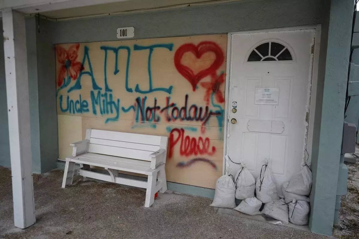
Boards on the window of a store display a message ahead of the arrival of Hurricane Milton, in Bradenton Beach on Anna Maria Island, Fla., Tuesday, Oct. 8, 2024. (AP Photo/Rebecca Blackwell)
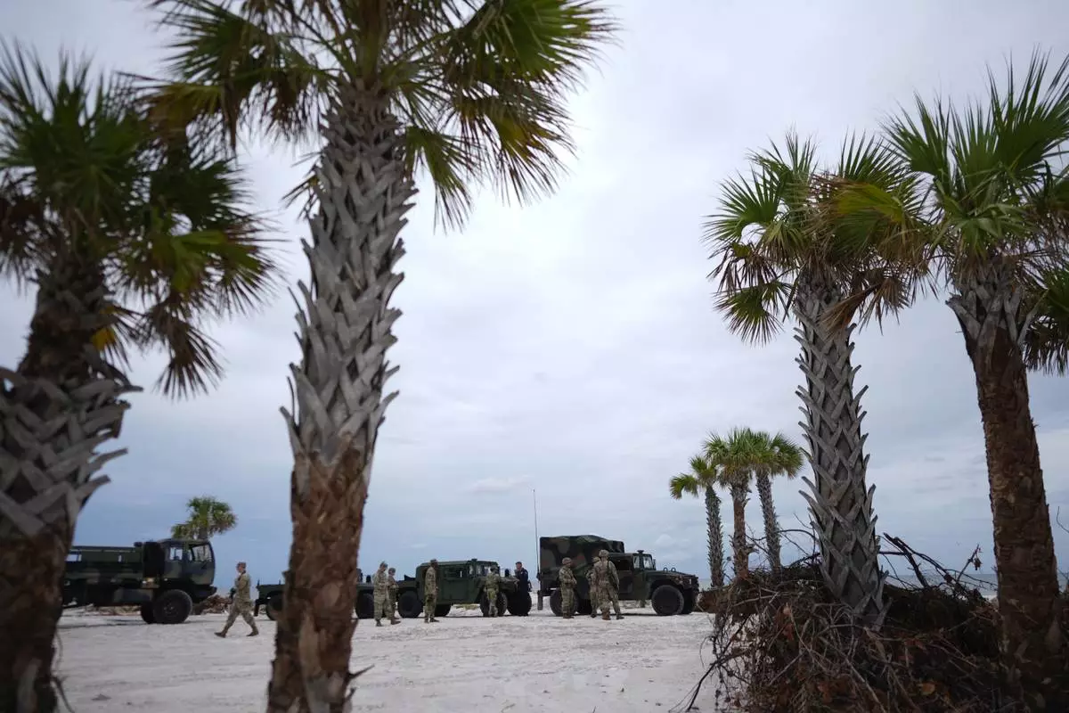
Members of the Florida Army National Guard stage on a beach as they prepare for the arrival of Hurricane Milton, in Bradenton Beach on Anna Maria Island, Fla., Tuesday, Oct. 8, 2024. (AP Photo/Rebecca Blackwell)
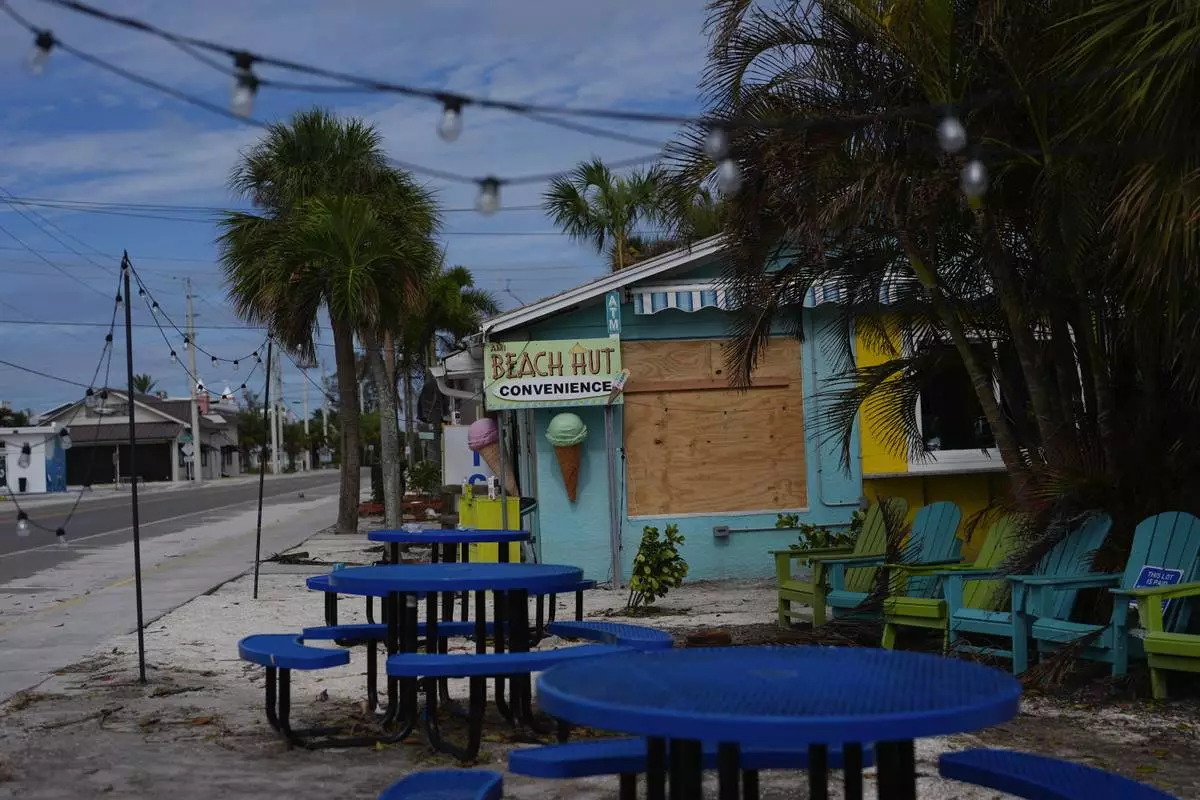
A boarded up business stands beside a deserted street in an evacuation zone, ahead of the arrival of Hurricane Milton, in Anna Maria, Fla., on Anna Maria Island, Tuesday, Oct. 8, 2024. (AP Photo/Rebecca Blackwell)