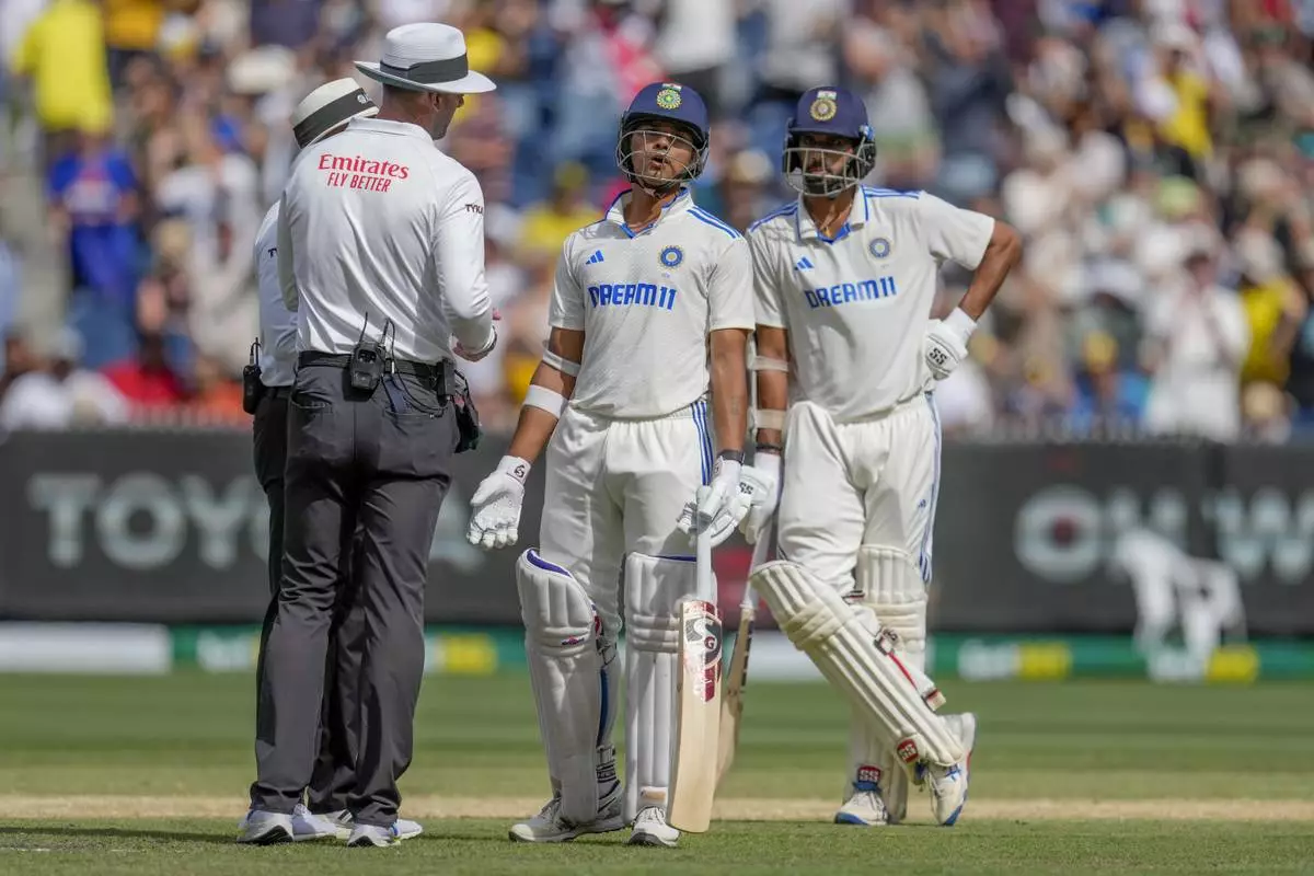
MELBOURNE, Australia (AP) — India captain Rohit Sharma says India is consistently on the “wrong side” of contentious video reviews, including Monday’s match-turning dismissal of opener Yashasvi Jaiswal.
Jaiswal was on 84 in India’s second innings in the fourth test at the Melbourne Cricket Ground, as the visiting side reached 140-6 in the 71st over of a scheduled 92-over innings.
With a draw seemingly within India’s grasp, Australia appealed for a caught-behind off the bowling of skipper Pat Cummins, which was turned down by on-field umpire Joel Wilson.
Australia called for a video referral. While the Ultra-edge technology did not show contact with bat or glove as the ball went past, replays appeared to indicate the ball came off the bat, or glove, or both. The third umpire decided there was enough evidence to overturn the on-field umpire’s original decision of not out.
“Really, I don’t know what to make of that because the technology didn’t show anything,” Sharma said. “I feel we’ve been a little bit unfortunate. I don’t know how the umpires want to use the technology.
“It’s about the technology which we all know is not 100 per cent. We don’t really want to look too much into that.
“It’s just that more often than not, we are the ones falling on the wrong side of it.
But Sharma conceded Jaiswal had made contact with the ball.
“In all fairness I think he did touch the ball. With the naked eye, it seemed that he did touch something,” he said.
Jaiswal’s dismissal was a key moment in India’s collapse as the visiting side lost 7-34 during the final session as Australia completed its 184-run victory in the 80th over, with only 12 more overs scheduled to be bowled in the final hour.
AP cricket: https://apnews.com/hub/cricket

Australian players celebrates the wicket of India's Yashasvi Jaiswal during play on the last day of the fourth cricket test between Australia and India at the Melbourne Cricket Ground, Melbourne, Australia, Monday, Dec. 30, 2024. (AP Photo/Asanka Brendon Ratnayake)

India's Yashasvi Jaiswal walks off the field after losing his wicket during play on the last day of the fourth cricket test between Australia and India at the Melbourne Cricket Ground, Melbourne, Australia, Monday, Dec. 30, 2024. (AP Photo/Asanka Brendon Ratnayake)

Australian players celebrates the wicket of India's Yashasvi Jaiswal during play on the last day of the fourth cricket test between Australia and India at the Melbourne Cricket Ground, Melbourne, Australia, Monday, Dec. 30, 2024. (AP Photo/Asanka Brendon Ratnayake)

India's Yashasvi Jaiswal, center, speaks to umpires after being dismissed during play on the last day of the fourth cricket test between Australia and India at the Melbourne Cricket Ground, Melbourne, Australia, Monday, Dec. 30, 2024. (AP Photo/Asanka Brendon Ratnayake)
Allied in World War II, Russia and Western European powers are now adversaries as they mark 80 years since the surrender of the Nazis.
Russia’s invasion of Ukraine has divided the continent anew, and the war and its daily death tolls loom large in victory commemorations and events across Europe.
Russian President Vladimir Putin has praised Russian troops fighting in Ukraine, saying “we are proud of their courage and determination, their spiritual force that always has brought us victory."
Putin was speaking during Friday's military parade. The Russian leader declared a unilateral 72-hour ceasefire starting Wednesday to coincide with the Victory Day celebrations, but warned that Russian troops will retaliate to any attacks.
Moscow has been reluctant to accept a U.S.-proposed 30-day truce that Ukraine has accepted, linking it to a halt in Western arms supplies to Ukraine and Kyiv’s mobilization effort, conditions Ukraine and its Western allies have rejected.
Ukrainian authorities reported scores of Russian strikes on Friday that killed at least two people in the Kherson and Zaporizhzhia regions and damaged buildings.
Ukrainian President Volodymyr Zelenskyy says he had a “good conversation” with Donald Trump, during which the two marked Victory Day and discussed the path toward peace in Ukraine.
Zelenskyy said Friday he briefed Trump on the battlefield situation and reiterated that Ukraine is ready for a 30-day ceasefire “starting even today,” urging Russia to support the proposal.
He emphasized Ukraine’s willingness to engage in talks “in any format” but said Russia must prove its commitment by declaring a full, unconditional ceasefire.
Zelenskyy added that Trump confirmed his desire to help end the war and supported the idea of a ceasefire, with both agreeing to remain in contact.
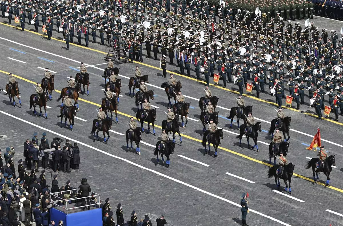
Russia began a vast military parade in Moscow's Red Square to mark the 80th anniversary of the defeat of Nazi Germany in World War II.
President Vladimir Putin and a host of foreign leaders, including Chinese President Xi Jinping, Brazilian President Luiz Inácio Lula da Silva and Slovakian Prime Minister Robert Fico, attended the parade.
A massive parade through Red Square and other ceremonies underline Moscow’s efforts to project its power and cement the alliances it has forged while seeking a counterbalance to the West amid the 3-year-old war in Ukraine.
Festivities this year were overshadowed by reports of Ukrainian drone attacks targeting Moscow and severe disruptions at the capital’s airports, as well as cellphone internet outages on Wednesday.
Victory Day, which celebrates the surrender of Nazi Germany that ended World War II, is Russia's most important secular holiday.
While most Western countries celebrate the anniversary on May 8, Russia celebrates it on May 9.
Gen. Dwight Eisenhower, supreme commander of the Allied forces in Europe, actually accepted the unconditional surrender of Nazi Germany at 2:41 a.m. local time on May 7, in a ceremony at Reims, France. Although the news leaked out by that evening, the official announcement was delayed until the following day as U.S., Britain and France tried to work out differences with the Soviet Union, which felt the surrender didn’t recognize the sacrifices its troops had made in securing victory.
A second surrender document was signed around midnight on May 8 in Berlin, satisfying Soviet concerns.

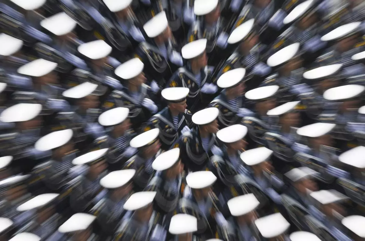
Russian servicemen attend the Victory Day military parade in Moscow, Russia, Friday, May 9, 2025, during celebrations of the 80th anniversary of the Soviet Union's victory over Nazi Germany during the World War II. (Pelagia Tikhonova/Photo host agency RIA Novosti via AP)

Mongolia's servicemen attend the Victory Day military parade in Moscow, Russia, Friday, May 9, 2025, during celebrations of the 80th anniversary of the Soviet Union's victory over Nazi Germany during the World War II. (Ilya Pitalev/Photo host agency RIA Novosti via AP)

Russian servicemen take part in the Victory Day military parade in Moscow, Russia, Friday, May 9, 2025, marking the 80th anniversary of the Soviet Union's victory over Nazi Germany during the World War II. (Maxim Bogovid/Photo host agency RIA Novosti via AP)

Uzbekistan's servicemen attend the Victory Day military parade in Moscow, Russia, Friday, May 9, 2025, during celebrations of the 80th anniversary of the Soviet Union's victory over Nazi Germany during the World War II. (Maxim Bogodvid/Photo host agency RIA Novosti via AP)

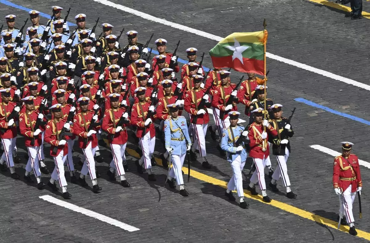
Myanmar's servicemen attend the Victory Day military parade in Moscow, Russia, Friday, May 9, 2025, during celebrations of the 80th anniversary of the Soviet Union's victory over Nazi Germany during the World War II. (Maxim Bogodvid/Photo host agency RIA Novosti via AP)

Russian servicemen attend the Victory Day military parade in Moscow, Russia, Friday, May 9, 2025, during celebrations of the 80th anniversary of the Soviet Union's victory over Nazi Germany during the World War II. (Alexander Wilf/Photo host agency RIA Novosti via AP)

Kyrgyzstan's servicemen attend the Victory Day military parade in Moscow, Russia, Friday, May 9, 2025, during celebrations of the 80th anniversary of the Soviet Union's victory over Nazi Germany during the World War II. (Maxim Bogodvid/Photo host agency RIA Novosti via AP)

Russian military troops attend the Victory Day military parade in Moscow, Russia, Friday, May 9, 2025, during celebrations of the 80th anniversary of the Soviet Union's victory over Nazi Germany during the World War II. (Maxim Bogodvid/Photo host agency RIA Novosti via AP)

Russian servicemen attend the Victory Day military parade in Moscow, Russia, Friday, May 9, 2025, during celebrations of the 80th anniversary of the Soviet Union's victory over Nazi Germany during the World War II. (Ramil Sitdikov/Photo host agency RIA Novosti via AP)

Vietnamese servicemen march during the Victory Day military parade in Moscow, Russia, Friday, May 9, 2025, celebrating the 80th anniversary of the Soviet Union's victory over Nazi Germany during the World War II. (Ilya Pitalev/Photo host agency RIA Novosti via AP)

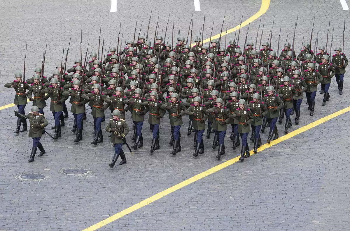
Russian servicemen march during the Victory Day military parade in Moscow, Russia, Friday, May 9, 2025, celebrating the 80th anniversary of the Soviet Union's victory over Nazi Germany during the World War II. (Vladimir Astapkovich/Photo host agency RIA Novosti via AP)

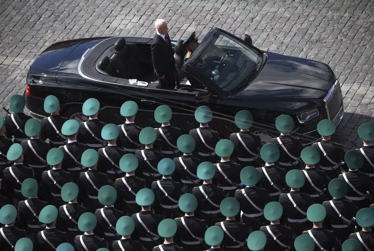
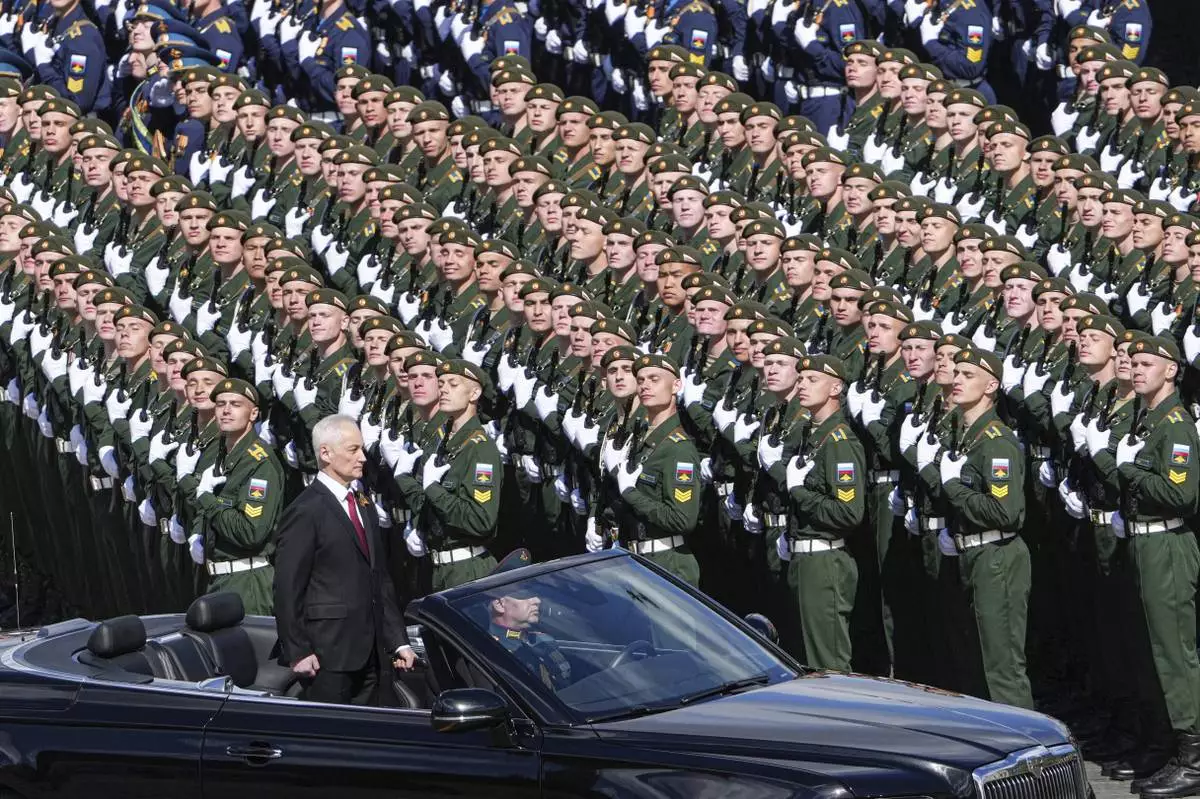
Russian Defense Minister Andrei Belousov is driven along Red Square in an Aurus car during the Victory Day military parade in Moscow, Russia, Friday, May 9, 2025, marking the 80th anniversary of the Soviet Union's victory over Nazi Germany during the World War II. (Vladimir Astapkovich/Photo host agency RIA Novosti via AP)

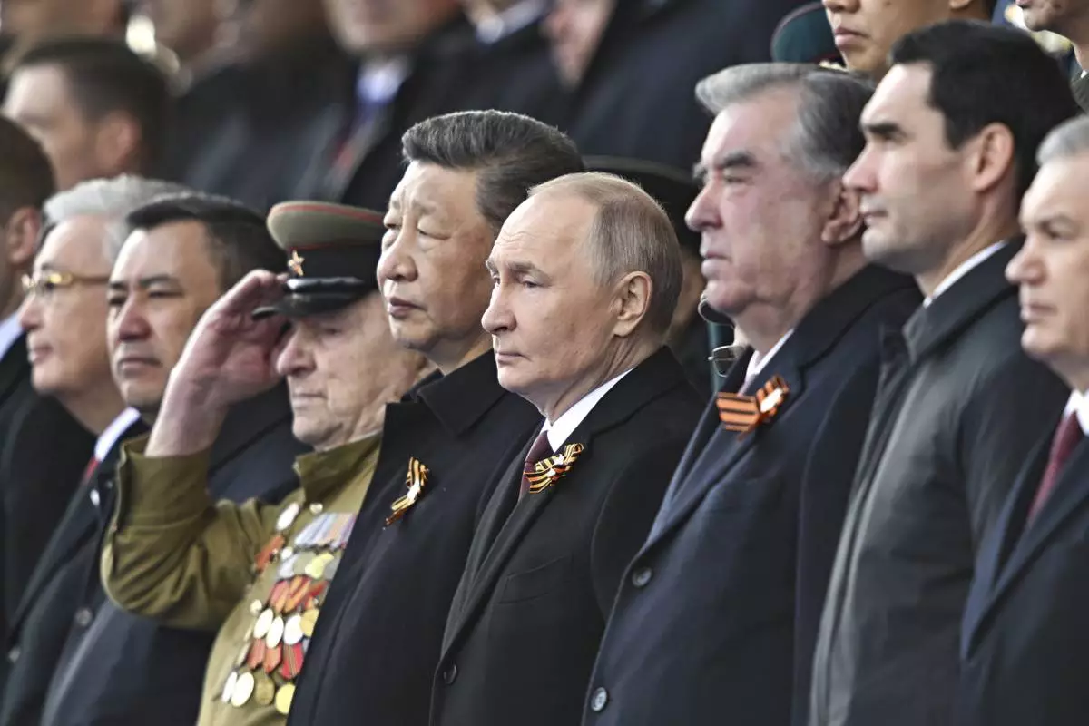
From second right: Turkmenistan President Serdar Berdimuhamedow, Tajikistan's President Emomali Rakhmon, Russian President Vladimir Putin and Chinese President Xi Jinpin watch the Victory Day military parade in Moscow, Russia, Friday, May 9, 2025, during celebrations of the 80th anniversary of the Soviet Union's victory over Nazi Germany during the World War II. (Sergei Bobylev/Photo host agency RIA Novosti via AP)

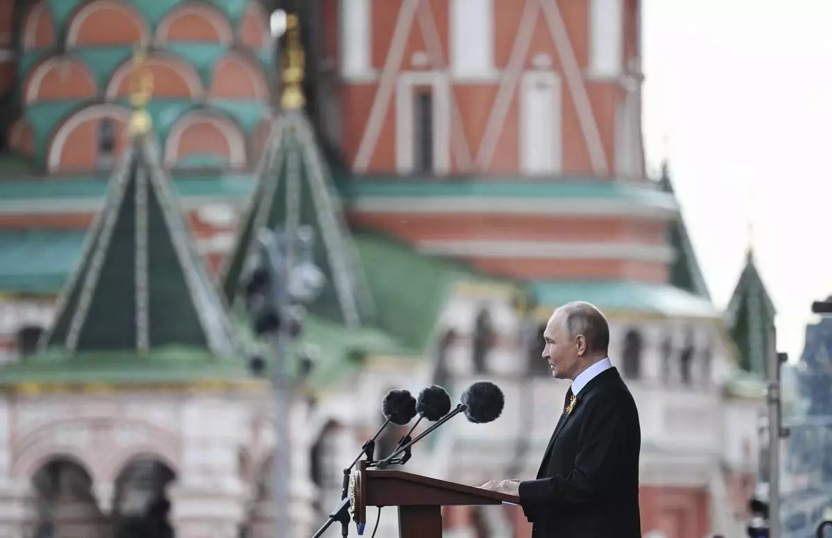
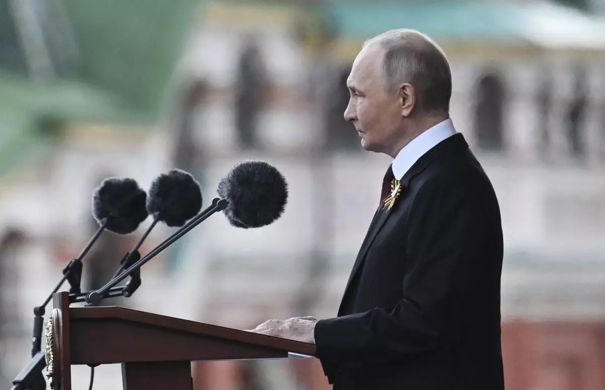
Russian President Vladimir Putin speaks during the Victory Day military parade in Moscow, Russia, Friday, May 9, 2025, during celebrations of the 80th anniversary of the Soviet Union's victory over Nazi Germany during the World War II. (Ilya Pitalev/Photo host agency RIA Novosti via AP)

Russian Defense Minister Andrei Belousov is driven along Red Square in an Aurus car during the Victory Day military parade in Moscow, Russia, Friday, May 9, 2025, marking the 80th anniversary of the Soviet Union's victory over Nazi Germany during the World War II. (Alexander Wilf/Photo host agency RIA Novosti via AP)

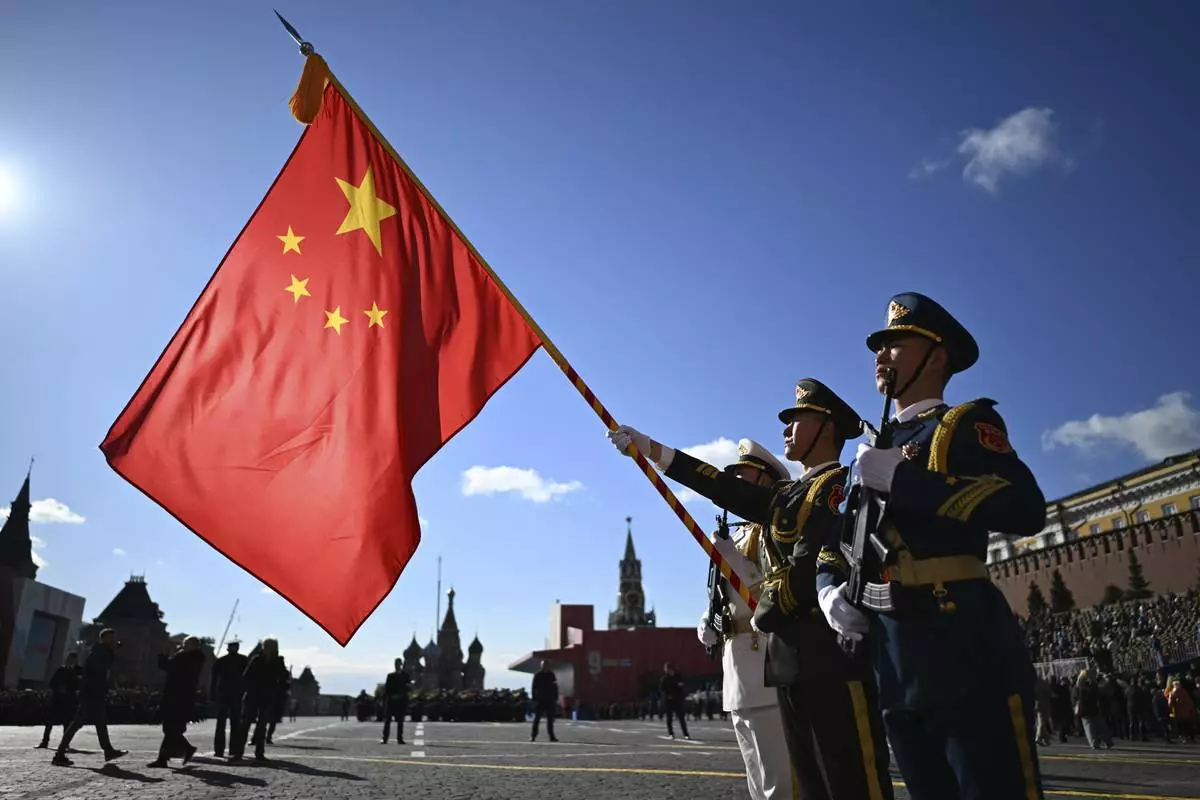
Chinese servicemen hold their national flag as they attend the Victory Day military parade in Moscow, Russia, Friday, May 9, 2025, during celebrations of the 80th anniversary of the Soviet Union's victory over Nazi Germany during the World War II. (Pelagia Tikhonova/Photo host agency RIA Novosti via AP)

Russian President Vladimir Putin speaks during the Victory Day military parade in Moscow, Russia, Friday, May 9, 2025, during celebrations of the 80th anniversary of the Soviet Union's victory over Nazi Germany during the World War II. (Ilya Pitalev/Photo host agency RIA Novosti via AP)

Russian servicemen take part in the Victory Day military parade in Moscow, Russia, Friday, May 9, 2025, marking the 80th anniversary of the Soviet Union's victory over Nazi Germany during the World War II. (Alexander Wilf/Photo host agency RIA Novosti via AP)

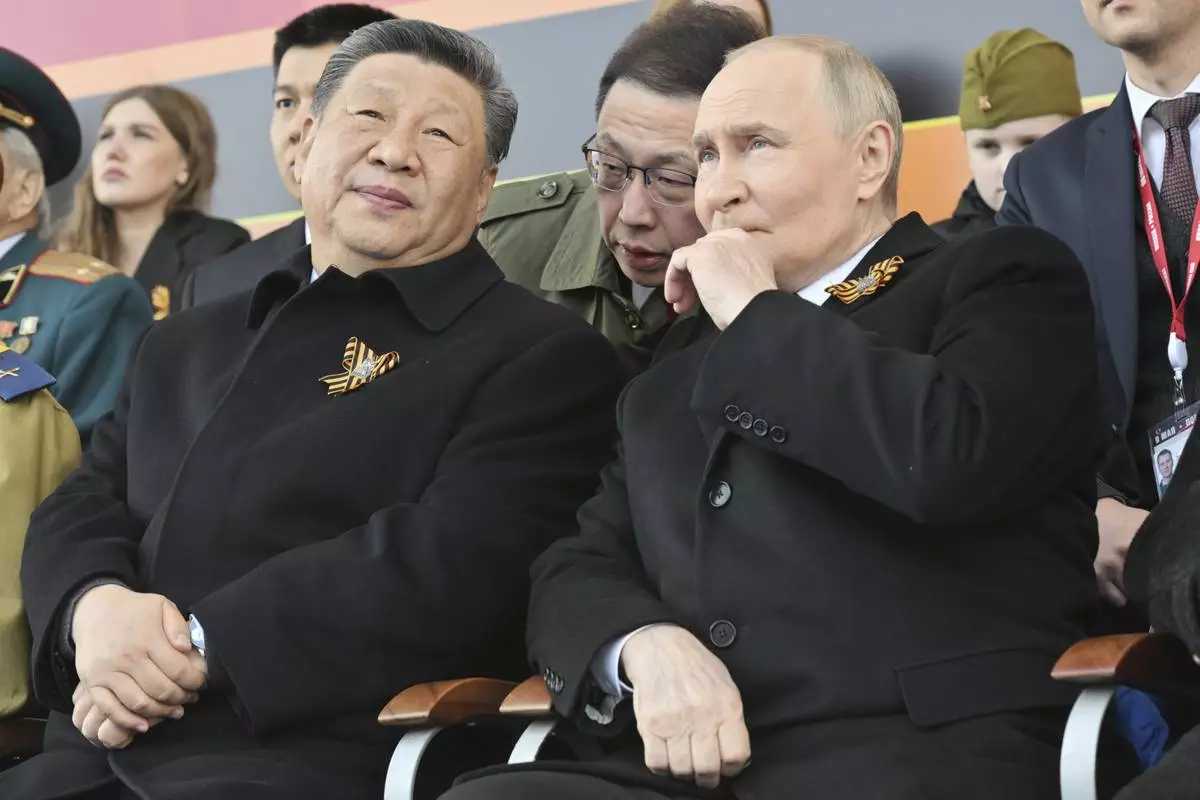
Russian President Vladimir Putin, right, and Chinese President Xi Jinpin watch the Victory Day military parade in Moscow, Russia, Friday, May 9, 2025, during celebrations of the 80th anniversary of the Soviet Union's victory over Nazi Germany during the World War II. (Mikhail Korytov/Photo host agency RIA Novosti via AP)

Russian President Vladimir Putin, centre right, and Chinese President Xi Jinpin, centre, watch the Victory Day military parade in Moscow, Russia, Friday, May 9, 2025, during celebrations of the 80th anniversary of the Soviet Union's victory over Nazi Germany during the World War II. (Mikhail Korytov/Photo host agency RIA Novosti via AP)


