GENEVA (AP) — Belgian soccer federation president Pascale van Damme is set join FIFA's ruling council after being the only candidate to run for a seat reserved for a female official from Europe.
Van Damme will run unopposed and is set to be elected at a UEFA meeting on April 3 in Belgrade, Serbia, UEFA said Monday.
Van Damme, a former technology industry executive, was elected to lead Belgian soccer less than two years ago. She is in line to get a four-year term in the FIFA post that pays $250,000 annually.
She will replace Evelina Christillin, a former 2006 Turin Olympics official with close ties to the Juventus-owning Agnelli family, who leaves after more than eight years in the role.
In 2016, Christillin was the first woman elected by UEFA to join the 37-member FIFA council.
Each of soccer’s six continental confederations has a place reserved for a woman on the FIFA decision-making body, and none has ever elected a woman in a contested vote against men.
UEFA also is set to re-elect four men to the FIFA council on April 3 without any rival candidates: Răzvan Burleanu of Romania, Georgios Koumas of Cyprus, Bernd Neuendorf of Germany and Dejan Savićević of Montenegro, the former AC Milan star.
All of the European candidates for FIFA positions, each one the president of their national soccer body, met a Jan. 3 deadline to enter the elections and must pass an eligibility check managed by the world soccer body.
UEFA has set a Feb. 3 deadline — two months before the congress in Belgrade — for candidates to enter elections for 10 vacant seats on its own executive committee, including that of David Gill, its treasurer and the former CEO at Manchester United. Gill has reached the 12-year term limit for UEFA elected positions.
One of the 10 vacancies is for a second seat protected for women, joining current UEFA vice president Laura McAllister of Wales who was elected two years ago. Candidates for the second quota place likely will include Norwegian federation president Lise Klaveness.
AP soccer: https://apnews.com/hub/soccer

FILE - President of Belgian Football Association Pascale van Damme, center, attends the FIFA Congress in Bangkok, Thailand, Friday, May 17, 2024. (AP Photo/Sakchai Lalit, File)
One person died and two others were pulled from the wreckage of a partially collapsed church on Friday, after severe storms including a possible tornado swept through St. Louis.
Several other people were reported injured after the Friday afternoon storms, which tore roofs off some buildings, ripped bricks off of siding and downed trees and power lines as residents were urged to take cover.
At Centennial Christian Church, City of St. Louis Fire Department Battalion Chief William Pollihan told The Associated Press that three people had to be rescued after part of the church crumbled. One of those people died.
National Weather Service radar indicated that a tornado touched down between 2:30 p.m. and 2:50 p.m. in Clayton, Missouri, in the St. Louis area. It received reports of damages, mostly downed trees, weather service meteorologist Marshall Pfahler said.
The apparent tornado touched down in the area of Forest Park, home to the St. Louis Zoo and the site of the 1904 World’s Fair and Olympic Games the same year, Pfahler said.
The St. Louis Zoo posted a message on X, the messaging platform formerly known as Twitter, that it would remain closed for the rest of the day because of the weather. The post included no information on damages, a zoo spokesperson didn’t immediately return a phone message seeking comment.
“We can’t definitively say whether or not it was a tornado -- it likely was,” Pfahler said.
Radar confirmed a tornado above Venice, Illinois, about 2:50 p.m. CDT. It could be accompanied by golf ball-size hail, the National Weather Service in St. Louis said. Venice is northeast of St. Louis, just across the Mississippi River.
The weather service described the tornado as “extremely dangerous” and moving east at 50 mph. The tornado is part of a severe weather system that spawned tornadoes in Wisconsin, downed trees, left thousands without power in the Great Lakes region and brought a punishing heat wave to Texas.
Weather forecasters warned that severe storms with hail and even hurricane-force winds also could hobble parts of Appalachia and the Midwest on Friday. Tornadoes were also a risk there.
The National Weather Service said severe weather was likely across parts of the central Appalachians and the Mid-Atlantic states. Residents in Kentucky, southern Indiana, southern Illinois, parts of Tennessee, Missouri, Arkansas and Ohio should brace for intense storms that could include baseball-sized hail.
The weather service's Storm Prediction Center said that “strong, potentially long-track tornadoes and very large hail” could be expected. The threat for damaging winds in excess of 75 mph will increase into this evening as storms grow into larger clusters.
Ahead of Friday night’s anticipated storm, Appalachian Power, which serves 1 million customers in West Virginia, Virginia and Tennessee, said Friday it requested 1,700 additional workers from neighboring utilities along with sending its own crews from unaffected areas to assist with service restoration.
Kentucky Gov. Andy Beshear, in a post on the social media platform X, put residents on notice.
“Kentucky, there is a dangerous weather system moving through our state with a significant round this afternoon through tonight. Strong winds, hail, flooding and tornadoes are possible starting at 2 p.m. CT in Western Kentucky and reaching Louisville around 5 p.m. ET,” he said.
Shelters were opening in the Paducah, Kentucky, area.
Faith Borden, a meteorologist in the National Weather Service Nashville office, said Friday that middle Tennessee could expect "all types of severe weather. Winds up to 70 mph. We’re talking seriously large hail up to 3 inches, which for us is big hail.”
Texas, meanwhile, faced searing heat. A heat advisory was issued for the San Antonio and Austin, with temperatures at a blistering 95 F (35 C) to 105 (40.5 C). Parts of the southern East Coast, from Virginia to Florida, battled with heat in the 90s.
The National Weather Service Office for Austin/San Antonio said Friday the humidity coming in over the weekend is expected to make temperatures hotter.
“There are concerns of heat exhaustion for people that aren’t taking proper precautions when they’re outdoors,” meteorologist Jason Runyen said. He advised those affected to take breaks and stay hydrated.
Overnight Thursday, storms accompanied by booming thunder, lightning displays and powerful winds swept through parts of Wisconsin, Illinois, northern Indiana and Michigan — leaving scores of trees down and thousands of homes without power.
Several tornadoes touched down Thursday in central Wisconsin. None of the twisters have received ratings yet, said Timm Uhlmann, a National Weather Service meteorologist in Green Bay.
“We’re still gathering reports,” Uhlmann said. “We’re assessing some of the damage and still getting video and pictures. The damage that we have is fairly widespread. There was a lot of large hail. In Eau Claire was one report of softball-sized hail.”
No injuries have been reported.
Surveys also were underway Friday of damage in Michigan to determine if any tornadoes touched down there, said Steven Freitag, a meteorologist with the National Weather Service in White Lake Township, northwest of Detroit.
The storms were fueled by temperatures in the lower 80s that stretched from Illinois into Michigan and were activated by a cold front that pushed through, Freitag said.
By midday Friday, about 230,000 customers were without power in Michigan. An estimated 60,000 were without power in Indiana. Another 27,000 in total had no electricity in Illinois and Kentucky.
The threat of severe weather in Chicago delayed a Beyonce concert by about two hours Thursday at Soldier Field.
Associated Press writer Haya Panjwani in Washington and Heather Hollingsworth in Kansas City, Missouri, contributed to this story.

Cody Sparks, left, and Eric Combs with Lewis Tree Service work to clear a tree off of a power line near on 92nd Street near Caledonia, Mich. on Friday, May 16. 2025. (Neil Blake/The Grand Rapids Press via AP)
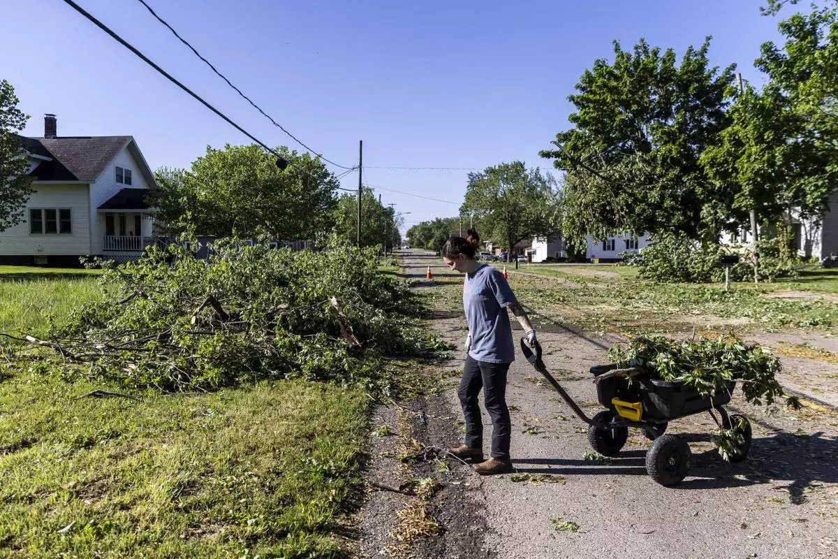
Zeeland resident Maddie Pellegrini clears debris outside her family's home on 64th Avenue in Drenthe east of Zeeland, Mich. on Friday, May 16, 2025. (Isaac Ritchey/The Grand Rapids Press via AP)
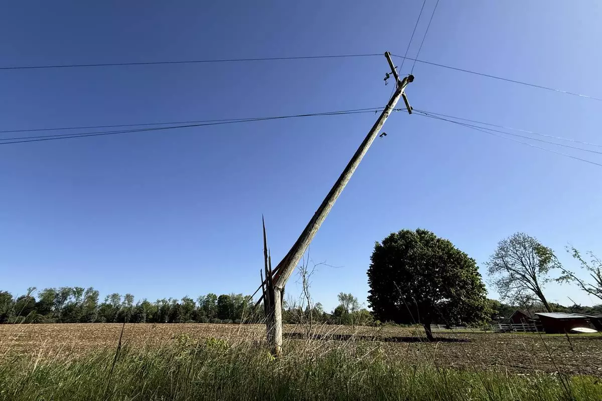
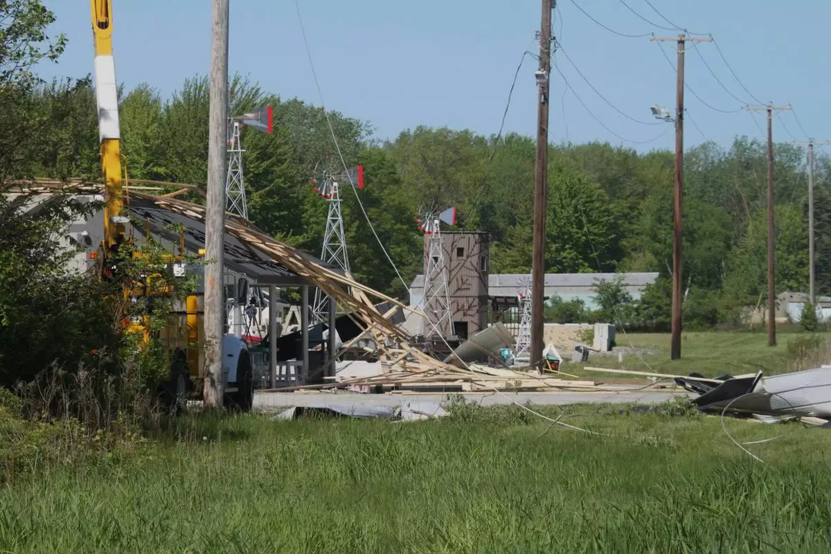
A snapped utility pole stands awkwardly off of 92nd Street near Caledonia, Mich. on Friday, May 16. 2025. (Neil Blake/The Grand Rapids Press via AP)
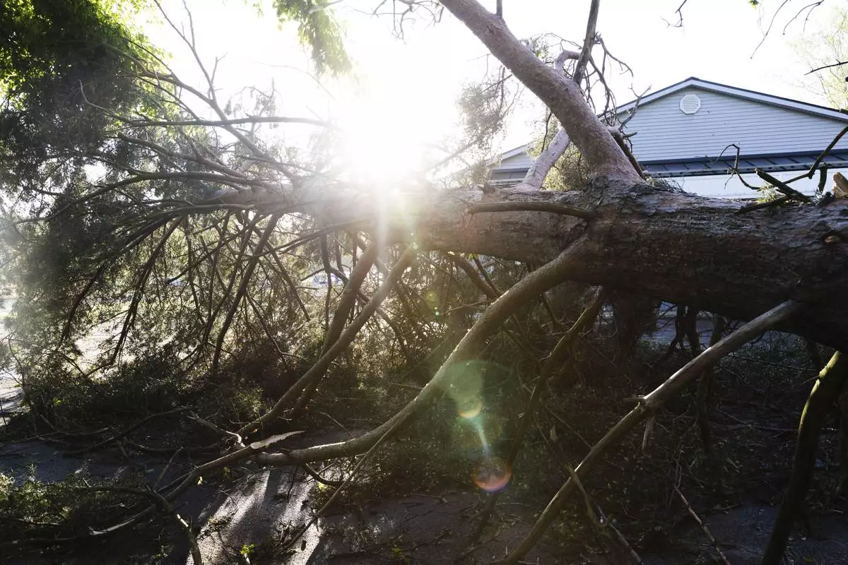
A tree is uprooted from Thursday night's storm in Trail Creek, Ind., on Friday, May 16, 2025. (Donavan Barrier /La Porte County Herald-Dispatch via AP)
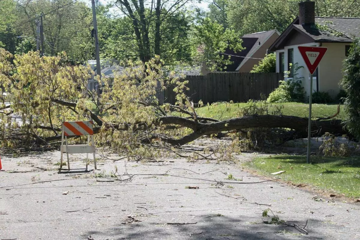
Downed trees are shown blocking Leo and Oakland Avenues in Trail Creek, Ind., on Friday, May 16, 2025. (Donavan Barrier /La Porte County Herald-Dispatch via AP)

A snapped tree is shown up against an apartment on Salem Court in Michigan City, Ind. on Friday, May 16, 2025. (Donavan Barrier /La Porte County Herald-Dispatch via AP)
Damage from Thursday's storm is shown along U.S. 20 in Michigan City, Ind., on Friday, May 16, 2025. (Donavan Barrier /La Porte County Herald-Dispatch via AP)
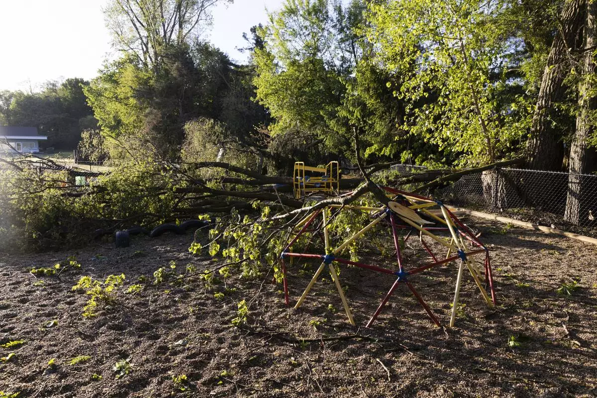
Trees lay in a playground in Dorr, Mich., after a severe storm ripped across Michigan the night before, on Friday, May 16. 2025. (Neil Blake /The Grand Rapids Press via AP)
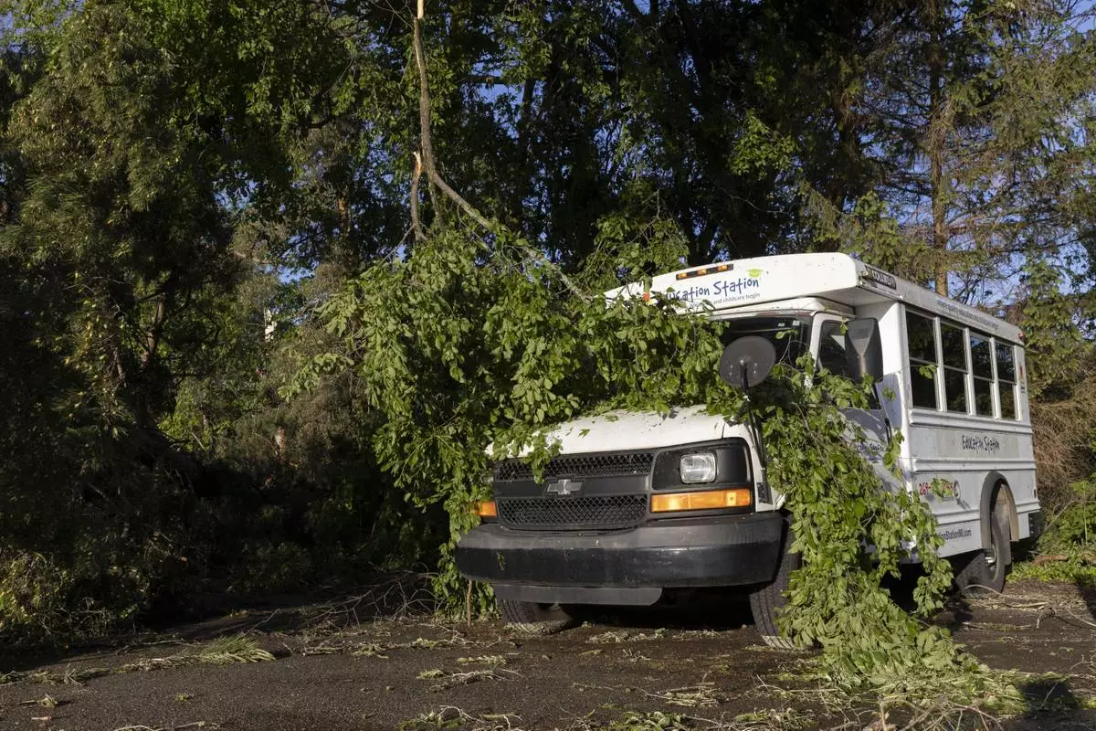
A tree branch covers a bus in Dorr, Mich., after a severe storm ripped across Michigan the night before, on Friday, May 16. 2025. (Neil Blake /The Grand Rapids Press via AP)
A tree lays in a parking lot in Dorr, Mich., after a severe storm ripped across Michigan the night before, on Friday, May 16. 2025. (Neil Blake /The Grand Rapids Press via AP)
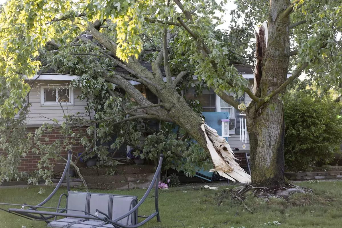
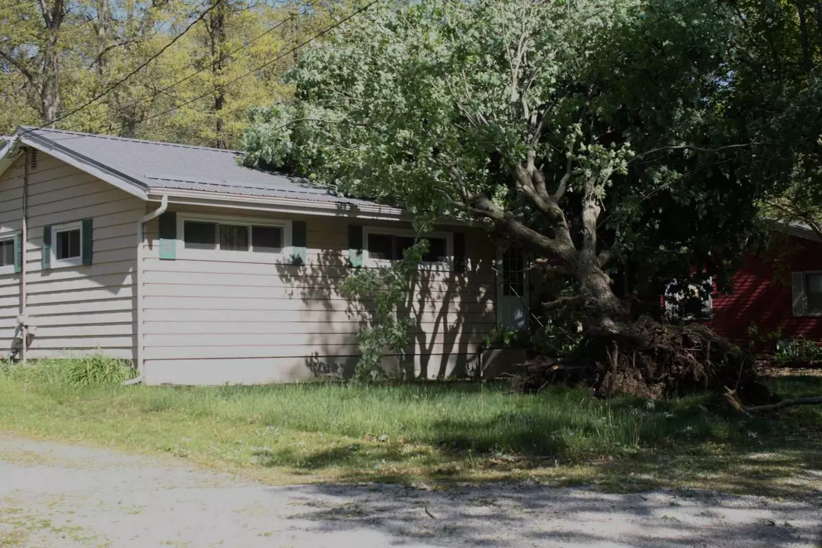
A tree lays on a house in Dorr, Mich., after a severe storm ripped across Michigan the night before, on Friday, May 16. 2025. (Neil Blake /The Grand Rapids Press via AP)