Ancient Western maps indicate that European recognition of China's sovereignty over the South China Sea dates back several centuries, according to cartography experts.
The issue has drawn renewed attention following controversy sparked by Google Maps, which recently relabeled parts of the South China Sea near the Philippines as the "West Philippine Sea." The move prompted a formal protest from China, which emphasized that the term "South China Sea" is internationally recognized and widely used by the United Nations and other global organizations.
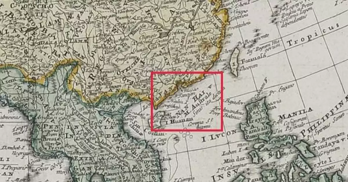
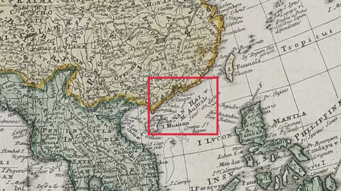
In an interview with China Global Television Network (CGTN), Xu Panqing, a professor at Shanghai University, noted that the South China Sea had been clearly marked on maps as early as 1730.
"As early as 1730, the South China Sea was marked on our maps. We have found over 50 maps in which the South China Sea's geographical scope and area are essentially the same as they are today," said Xu.
These ancient Western maps reveal a fascinating historical pattern -- a consistent use of names for the South China Sea that are directly translated or transcribed from Chinese terms, including South China Sea, China Sea and most notably, the pinyin form "Nanhai."
The appearance of these designations on European maps can be traced back to the 18th century, drawing from China’s extensive cartographic efforts, particularly the renowned Kangxi Atlas -- a comprehensive map of the imperial territories commissioned by Emperor Kangxi.
"The Kangxi Emperor commissioned a comprehensive map of the empire, and Jesuit missionaries helped complete it. These maps were later taken to Europe, where they clearly labeled the South China Sea as 'Nan-Hai,' often followed by translations in Latin, French, or German. This practice demonstrates early international recognition of China’s naming and mapping of the region," Xu said.
Xu noted that ancient maps also illustrate China's maritime presence, with island names derived from Chinese. Such cross-cultural naming highlights the international recognition of China’s sovereignty, centuries before modern disputes arose.
"For example, the name of Zhongyedao, 'Thitu', was derived from Chinese dialects. British researchers found that 'Thi' refers to fishing and 'Tu' refers to an island. The name likely described an island for subsistence fishing," Xu said.
Experts said these historical documents can serve as important legal evidence to support historical facts.
"Ancient maps are historical witnesses. They demonstrate China's early and consistent sovereignty over the South China Sea and its islands. These maps serve as vital evidence in international discourse, corroborating historical facts through clear depictions of Chinese presence and governancem,” said Mi Chenxi, a researcher at China Institute for Marine Affairs (CIMA) of the Ministry of Natural Resources.
"The naming of the South China Sea stemmed directly from Chinese terms affirms China's historical discovery, naming and governance of the South China Sea, demonstrating enduring international recognition of its sovereignty," said Chen Xidi, an assistant researcher at CIMA. While some in the West claim China only became aware of the South China Sea starting with Dongsha Qundao in 1907, experts say these fresh findings debunk the myth.
"We've proven the Chinese people lived in the South China Sea region before 1730. Additionally, the Chinese were familiar with the Zhongyedao early on, as demonstrated by the example of Thitu Island," said Xu.
Ancient Western maps reflect centuries-old European recognition of China's sovereignty over South China Sea