BEIJING (AP) — A strong earthquake shook a high-altitude region of western China and areas of Nepal on Tuesday, damaging hundreds of houses, littering streets with rubble and killing at least 126 people in Tibet. Many others were trapped as dozens of aftershocks shook the remote region.
Rescue workers climbed mounds of broken bricks, some using ladders in heavily damaged villages, as they searched for survivors. Videos posted by China's Ministry of Emergency Management showed two people being carried on stretchers by workers treading over the debris from collapsed homes.
At least 188 people were injured in Tibet on the Chinese side of the border, the official Xinhua News Agency said.
More than 1,000 homes were damaged in the barren and sparsely populated region, state broadcaster CCTV reported. In video posted by the broadcaster, building debris littered streets and crushed cars.
People in northeastern Nepal strongly felt the earthquake, but there were no initial reports of injuries or damage, according to the country's National Emergency Operation Center. The area around Mount Everest, about 75 kilometers (50 miles) southwest of the epicenter, was empty in the depth of winter when even some residents move away to escape the cold.
The quake woke up residents in Nepal’s capital of Kathmandu — about 230 kilometers (140 miles) from the epicenter — and sent them running into the streets.
The U.S. Geological Survey said the earthquake measured magnitude 7.1 and was relatively shallow at a depth of about 10 kilometers (6 miles). China's Earthquake Networks Center recorded the magnitude as 6.8. Shallow earthquakes often cause more damage.
The epicenter was in Tibet's Tingri county, where the India and Eurasia plates grind against each other and can cause earthquakes strong enough to change the heights of some of the world’s tallest peaks in the Himalayan mountains.
Tibet is part of China, but many Tibetans’ loyalties lie with the Dalai Lama, the spiritual leader who has lived in exile in India since a failed anti-Chinese uprising in 1959. Western governments and human rights organizations have repeatedly accused the Chinese government of abuses in Tibet, where it has cracked down on dissent while investing heavily in economic development.
There have been 10 earthquakes of at least magnitude 6 in the area where Tuesday’s quake hit over the past century, the USGS said.
About 150 aftershocks were recorded in the nine hours after the earthquake, and the Mount Everest scenic area on the Chinese side was closed.
Chinese leader Xi Jinping called for all-out efforts to rescue people, minimize casualties and resettle those whose homes were damaged. More than 3,000 rescuers were deployed, CCTV said.
Vice Premier Zhang Guoqing was dispatched to the area to guide the work, and the government announced the allocation of 100 million yuan ($13.6 million) for disaster relief.
About 6,900 people live in three townships and 27 villages within 20 kilometers (12.5 miles) of the epicenter on the Chinese side, state media said. The average altitude in the area is about 4,200 meters (13,800 feet), the Chinese earthquake center said in a social media post.
On the southwest edge of Kathmandu, a video showed water spilling out into the street from a pond in a courtyard with a small temple.
“It is a big earthquake," a woman can be heard saying. "People are all shaking.”
Associated Press writer Binaj Gurubacharya in Kathmandu, Nepal, and researcher Yu Bing in Beijing contributed to this report.
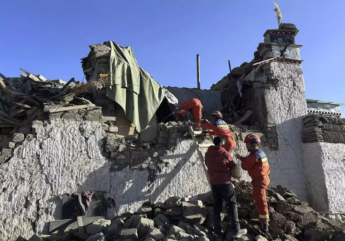
In this photo released by Xinhua News Agency, rescue workers search for survivors in the aftermath of an earthquake in Changsuo Township of Dingri in Xigaze, southwestern China's Tibet Autonomous Region on Tuesday, Jan. 7, 2025. (Xinhua via AP)
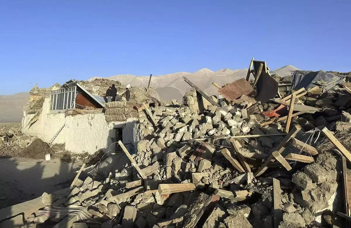
In this photo released by Xinhua News Agency, people stand amidst damaged houses in the aftermath of an earthquake in Tonglai Village, Changsuo Township of Dingri in Xigaze, southwestern China's Tibet Autonomous Region on Tuesday, Jan. 7, 2025. (Xinhua via AP)
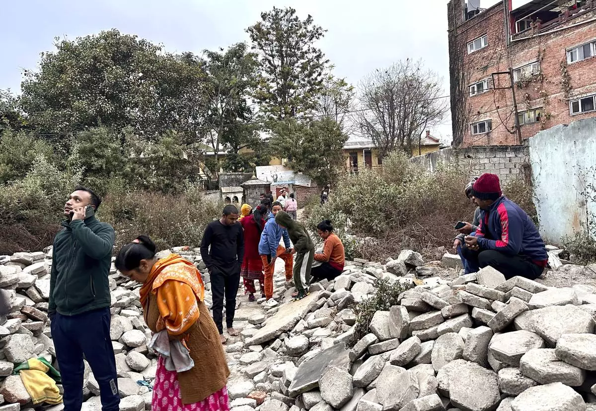
Nepalese people look on after rushing out of their homes after experiencing an earthquake in Kathmandu, Nepal, Tuesday, Jan.7, 2025. (AP Photo/Sunil Sharma)

Nepalese people stand after rushing out of their homes after experiencing an earthquake in Kathmandu, Nepal, Tuesday, Jan.7, 2025. (AP Photo/Sunil Sharma)
Evacuating a wildfire area can be scary, but experts say people can significantly improve their own safety with a little preparation and common sense.
Creating a wildfire action plan, packing a “go bag” and maintaining basic situational awareness during evacuations can make a big difference when escaping a disaster, Jesse Torres, a battalion chief for the California Department of Forestry and Fire Protection, or Cal Fire, said
But the most important tip? Don't wait around for an evacuation order, Torres said.
“The biggest thing is to get out early, before the notifications come out. It’s so important to avoid the congestion,” he said. That’s especially true in areas that have narrow roadways or limited routes, Torres said, because traffic jams can form quickly: “Everyone’s doing the same thing — they’re all trying to get out.”
Here are some safety tips on what to do before and during a wildfire evacuation, and what to do if you get trapped.
Many communities, including several in California, have warning alert systems that allow residents to sign up for push notifications to their mobile phones or email accounts.
FEMA has a downloadable app that provides real-time alerts on mobile phones, and public safety agencies can also push alerts to television, radio and wireless devices through the Integrated Public Alert & Warning System. The NOAA Weather Radio All Hazards is a nationwide network of radio stations that broadcast continuous weather information as well as official Weather Service warnings, forecasts and other hazard information.
A battery- or crank-operated portable radio can also be a critical tool for receiving emergency alerts, especially in areas where cellular service is unreliable or when regional cellular towers might be threatened by wind, fire or other hazards.
Household emergency action plans help ensure that all members of a family know exactly what to do and where to go during a wildfire. The U.S. Department of Homeland Security says emergency plans should be tailored for a household's unique circumstances, taking into account things like special medical needs or whether a family has livestock.
Strong wildfire action plans typically include: A pre-arranged meeting point well outside the area of danger where household members can meet to determine who has evacuated; multiple escape routes out of the area so people know which way to go if one pathway to safety is blocked; arrangements for any family members with disabilities or medical conditions; arrangements for pets and livestock; and a communication plan that identifies someone outside the area to be the main contact point in case household members get separated.
When it's time to evacuate, having a pre-packed “go bag” or emergency supply kit can save valuable minutes, Torres said.
Cal Fire says a “go bag” should include a map with at least two evacuation routes; necessary prescriptions or medical items like eyeglasses; extra car keys, cash or credit cards; a basic first aid kit; a flashlight and battery-powered radio with extra batteries; and copies of important documents like passports or birth certificates. It should also include a three-day supply of non-perishable food and water per person, as well as food and water for any pets. N95 masks can help filter out many of the particles in wildfire smoke, and an extra cellphone battery or charger can also be helpful.
“Go bags” should be accessible and easy to grab in an emergency, Torres said.
“Plan like you're going on a trip for seven days. Have clothes, toilet paper, toothbrush, soap, a towel in there,” Torres said. “You might end up in an evacuation center, or you might end up with family, so be prepared.”
If time allows, the U.S. Department of Agriculture recommends connecting water hoses and filling garbage cans, tubs, pools and the like with water to help firefighters if they end up on your property.
“Close all your windows, and if you’re able to and aware of how to do it safely, shut off the gas and power to your home," he said. Closing doors, windows and vents will help prevent embers from blowing inside and catching the interior on fire, Torres said.
Even if you don't have a “go bag” or a wildfire action plan set up, don't dally if you feel like danger is near, Torres said.
Fires can move faster than humans, especially when they are driven by high winds. And all sorts of things, including downed power lines, thick smoke, abandoned cars, blowing debris and heavy traffic can impede escape routes during emergencies.
“Just get out of those warning- and evacuation order-zones. If you have family on the other side of the county, go to the other side of the county," Torres said. “Get out and get off the roadways as soon as possible.”
If you can't evacuate, your car breaks down or you get stuck for some other reason, don't panic, Torres said. Instead, take a look around and call 911.
“Realize where you are, what street you are at. Can you see an address sign? Call 911, so we can get resources out to you to try to find you,” Torres said.
Sometimes people lose sight of the fire during an evacuation, and it can be hard to tell where they are in all the smoke. An intersection or landmark can help emergency responders identify someone's location and determine if they are in immediate danger, he said. Again, it's crucial not to delay — go ahead and call 911 to “get that process started,” said Torres.
If someone can walk to a safe spot, they should do that, Torres said. In that scenario, stay on a main route if possible, because that increases the chances of being spotted by a passing car or emergency responder, he said.
A residence burns as the Palisades Fire advances in the Pacific Palisades neighborhood of Los Angeles, Tuesday, Jan. 7, 2025. (AP Photo/Etienne Laurent)