BARCELONA, Spain--(BUSINESS WIRE)--Mar 31, 2025--
AUTEL Energy Europe, a leading innovator in electric vehicle (EV) charging solutions, is pleased to announce its strategic partnership with Mer, a leading provider of charging solutions for electric vehicles dedicated to sustainable mobility. Under this collaboration, Mer and AUTEL will jointly integrate AUTEL’s comprehensive range of MaxiCharger AC products into Mer’s expanding charging network throughout key markets, including the Nordics, the UK, Germany, and Austria, to significantly increase the number of available charging plugs and facilitate Europe's transition to electric vehicles.
This press release features multimedia. View the full release here: https://www.businesswire.com/news/home/20250328427903/en/
This partnership marks a significant joint milestone in advancing accessible and efficient EV charging infrastructure across Europe. AUTEL’s MaxiCharger AC series offers advanced, high-performance solutions designed to accelerate the shift to electric mobility through reliable and user-friendly charging options suitable for residential, commercial, and public settings.
A distinctive feature of AUTEL’s MaxiCharger AC is its interactive screen, enhancing user engagement by clearly displaying essential charging information. Furthermore, the MaxiCharger AC Ultra series enables users to directly adjust charging settings via the screen, ensuring an intuitive and seamless charging experience.
“Partnering with Mer allows us to collectively deliver advanced MaxiCharger AC technology to a broader audience across key European regions, significantly expanding infrastructure availability and accessibility,” said Mr. Ting Cai, CEO of AUTEL Europe. “We are proud to actively support Mer’s vision of sustainable mobility by providing innovative, scalable, and reliable EV charging solutions.”
Mer is committed to promoting sustainable transportation through its extensive, clean-energy-powered charging network. Incorporating AUTEL’s MaxiCharger AC series will significantly enhance Mer’s service offerings, ensuring smooth and reliable charging experiences for EV drivers and contributing to the broader goal of sustainable mobility.
“Our collaboration with AUTEL aligns with our mission to make charging easy and reliable for all drivers and businesses across Europe," says Kristoffer Thoner, CEO at Mer. “AUTEL's expertise and technology in AC charging, combined with our joint efforts, will secure good and future-proof solutions to businesses.” The partnership will focus on increasing access to efficient EV charging solutions across Europe, reflecting both companies' shared commitment to accelerating electric vehicle adoption by making charging more accessible, efficient, and environmentally sustainable.
About AUTEL
AUTEL Energy Europe is a leading provider of innovative EV charging solutions, offering a complete range of high-performance AC and DC chargers. Active in 22 European countries, AUTEL emphasizes cutting-edge technology, reliability, and sustainability. The company collaborates closely with industry-leading partners to advance the future of e-mobility across Europe. For more information, please visit: https://autelenergy.eu/
About Mer
Mer is a European electric vehicle charging company who uses expertise and scale to amplify Europe’s transition to electric mobility. Mer has over 15 years of experience in the field with a presence in Norway, Sweden, Germany, Austria, and the United Kingdom. Mer is offering charging solutions along the road for electric vehicle drivers, and at workplaces, facilities, or other locations for Businesses. Mer’s mission is to make sustainable electric mobility easy and reliable for drivers and companies across Europe. For more information, please visit: https://mer.eco/.


AUTEL MaxiCharger AC Series
Tornadoes and violent storms struck parts of the South and Midwest on Wednesday, killing at least one person, knocking down power lines and trees, ripping roofs off homes and shooting debris thousands of feet into the air.
A tornado emergency was briefly issued in northeast Arkansas, with the National Weather Service telling residents on social media: “This is a life threatening situation. Seek shelter now.”
Dozens of tornado and severe thunderstorm warnings were issued in parts of Arkansas, Illinois, Indiana, Missouri and Mississippi as storms hit those and other states in the evening. Forecasters attributed the violent weather to daytime heating combining with an unstable atmosphere, strong wind shear and abundant moisture streaming into the nation's midsection from the Gulf.
The Missouri State Highway Patrol said at least one person was killed Wednesday in southeast Missouri, KFVS-TV reported.
The coming days were also forecast to bring the risk of potentially deadly flash flooding to the South and Midwest as severe thunderstorms blowing eastward become supercharged. The potent storm system will bring “significant, life-threatening flash flooding” each day through Saturday, the National Weather Service said.
With more than a foot (30 centimeters) of rain possible over the next four days, the prolonged deluge “is an event that happens once in a generation to once in a lifetime,” the weather service said. “Historic rainfall totals and impacts are possible.”
More than 90 million people were at some risk of severe weather in a huge part of the nation stretching from Texas to Minnesota and Maine, according to the Oklahoma-based Storm Prediction Center.
A tornado emergency was briefly declared around Blytheville, Arkansas, Wednesday evening, with debris lofted at least 25,000 feet (7.6 kilometers), according to Chelly Amin, a meteorologist with the weather service. That was the weather service’s highest alert, and rare. It was not immediately clear whether there were any injuries.
“It's definitely going to be a really horrible situation here come sunrise in the morning in those areas, coming out of Arkansas,” Amin said.
More than 2 miles (3 kilometers) of Highway 18 in the area was temporarily shut down due to a downed power line.
A tornado was also reported on the ground near Harrisburg, Arkansas, in the evening.
The Arkansas Division of Emergency Management reported that there was damage in 22 counties due to tornadoes, wind gusts, hail and flash flooding. At least four people were injured and there were no reports of fatalities as of Wednesday evening.
In Pilot Grove, Missouri, several structures were damaged, cars flipped over and power poles were snapped, the state emergency management agency said. Minor injuries were reported, according to the Missouri State Highway Patrol. Meanwhile roads were closed because of storm debris and downed utility lines near the town of Potosi, southwest of St. Louis, according to the state transportation department.
Authorities in eastern Missouri were trying to determine whether it was a tornado that damaged buildings, overturned vehicles and tore down utility poles, tree limbs and business signs in the morning in and around the city of Nevada.
Another tornado touched down in the northeastern Oklahoma city of Owasso about 6:40 a.m., according to the weather service office in Tulsa. There were no immediate reports of injuries, but the twister heavily damaged the roofs of homes and knocked down power lines, trees, fences and sheds.
Forecasters at the National Weather Service office in the area of Paducah, Kentucky, took cover during a warning at night.
“We’re all good here at the office, the circulation JUST missed us to the south,” the agency said on social media.
Power was knocked out to nearly 90,000 customers in Arkansas, Mississippi, Missouri, Illinois, Kentucky and Tennessee, according to PowerOutage.us, which tracks outages nationwide. As storms moved through Indiana on Wednesday night, more than 182,000 customers lost power.
News outlets reported part of a warehouse collapsed in Brownsburg, Indiana, a suburb of Indianapolis, temporarily trapping at least one person inside, while the police department told people to not travel through the city. Five semitrucks were blown over on Interstate 65 near Lowell, Indiana, state police reported.
The dangerous weather came nearly two years to the day after an EF-3 tornado struck Little Rock, Arkansas. No one was killed, but there was major destruction to neighborhoods and businesses that are still being rebuilt today.
About 2.5 million people were in a rarely called “high-risk” zone, covering parts of west Tennessee including Memphis; northeast Arkansas; the southeast corner of Missouri; and parts of western Kentucky and southern Illinois.
The Storm Prediction Center said “multiple long-track EF3+ tornadoes" were likely. Tornadoes of that magnitude are among the strongest on the Enhanced Fujita scale, used to rate their intensity.
At a slightly lower risk for severe weather was an area that included Chicago, Indianapolis, St. Louis and Louisville, Kentucky. Dallas, Detroit, Milwaukee and Nashville, Tennessee, were also at risk.
A line of thunderstorms dropped heavy rain through parts of Indiana on Wednesday night. At least one street was flooded in Indianapolis, with water nearly reaching the windows of several cars, according to the city's metropolitan police department. No one was in the vehicles.
Additional rounds of heavy rain were expected in parts of Texas, the lower Mississippi Valley and the Ohio Valley from midweek through Saturday. Forecasters warned that they could track over the same areas repeatedly, producing dangerous flash floods capable of sweeping cars away.
Middle Tennessee was looking at severe storms followed by four days of heavy rains as the front stalls out and sticks around through the weekend, according to NWS meteorologist Mark Rose.
“I don’t recall ever seeing one like this, and I’ve been here 30 years,” Rose said. “It’s not moving.”
Rain totaling up to 15 inches (38 centimeters) was forecast over the next seven days in northeastern Arkansas, the southeast corner of Missouri, western Kentucky and southern parts of Illinois and Indiana, the weather service warned, with some areas in Kentucky and Indiana at an especially high risk for flooding.
In Michigan, crews worked to restore power after a weekend ice storm. More than 122,000 customers were still without electricity on Wednesday, according to PowerOutage.us.
The Mackinac Bridge connecting Michigan’s Lower and Upper Peninsulas was shut down because large chunks of ice were falling from cables and towers. It was the third consecutive day of bridge interruptions from the ice storm.
Associated Press writers Andrew DeMillo in Little Rock, Arkansas; Adrian Sainz in Memphis, Tennessee; Seth Borenstein in Washington; Isabella O'Malley in Philadelphia; Ed White in Detroit; and Hallie Golden in Seattle contributed.

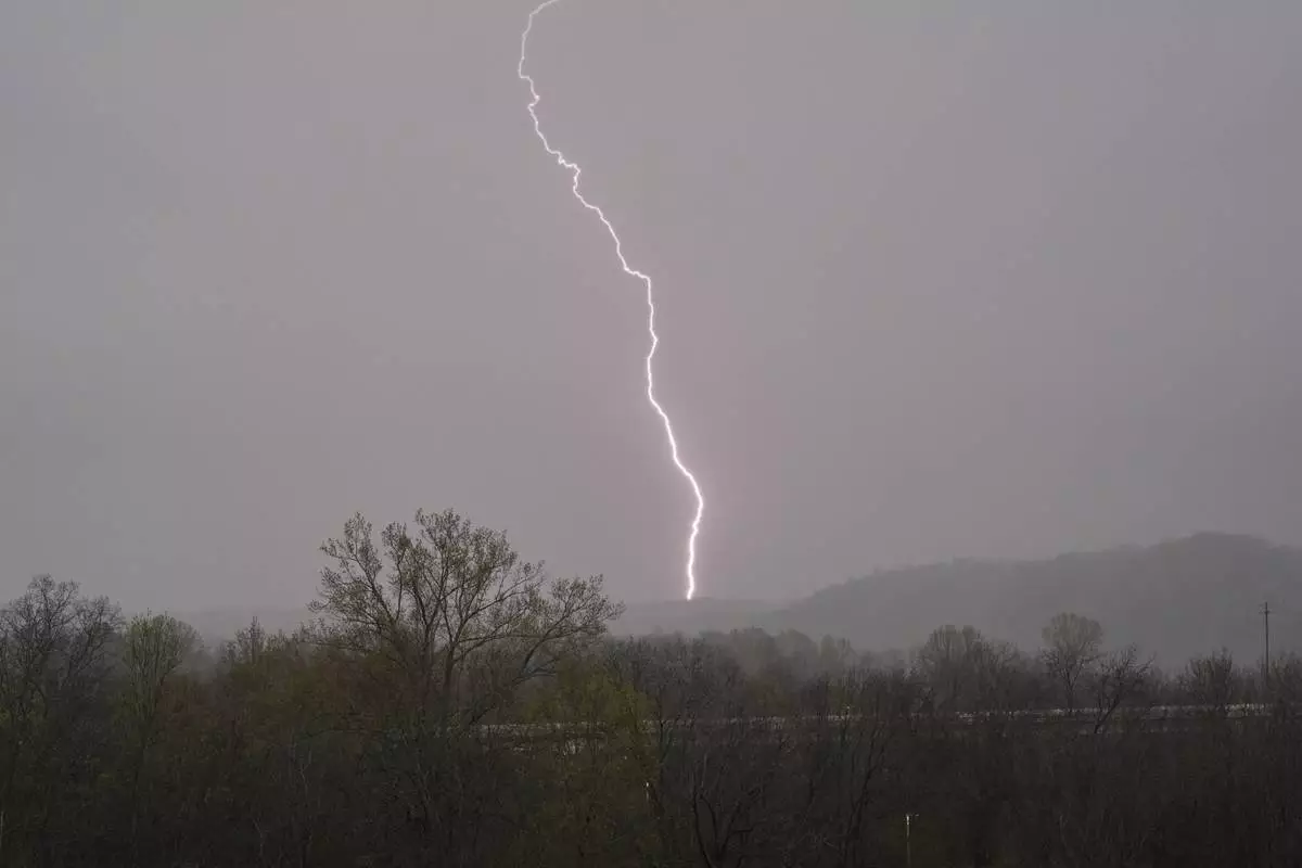
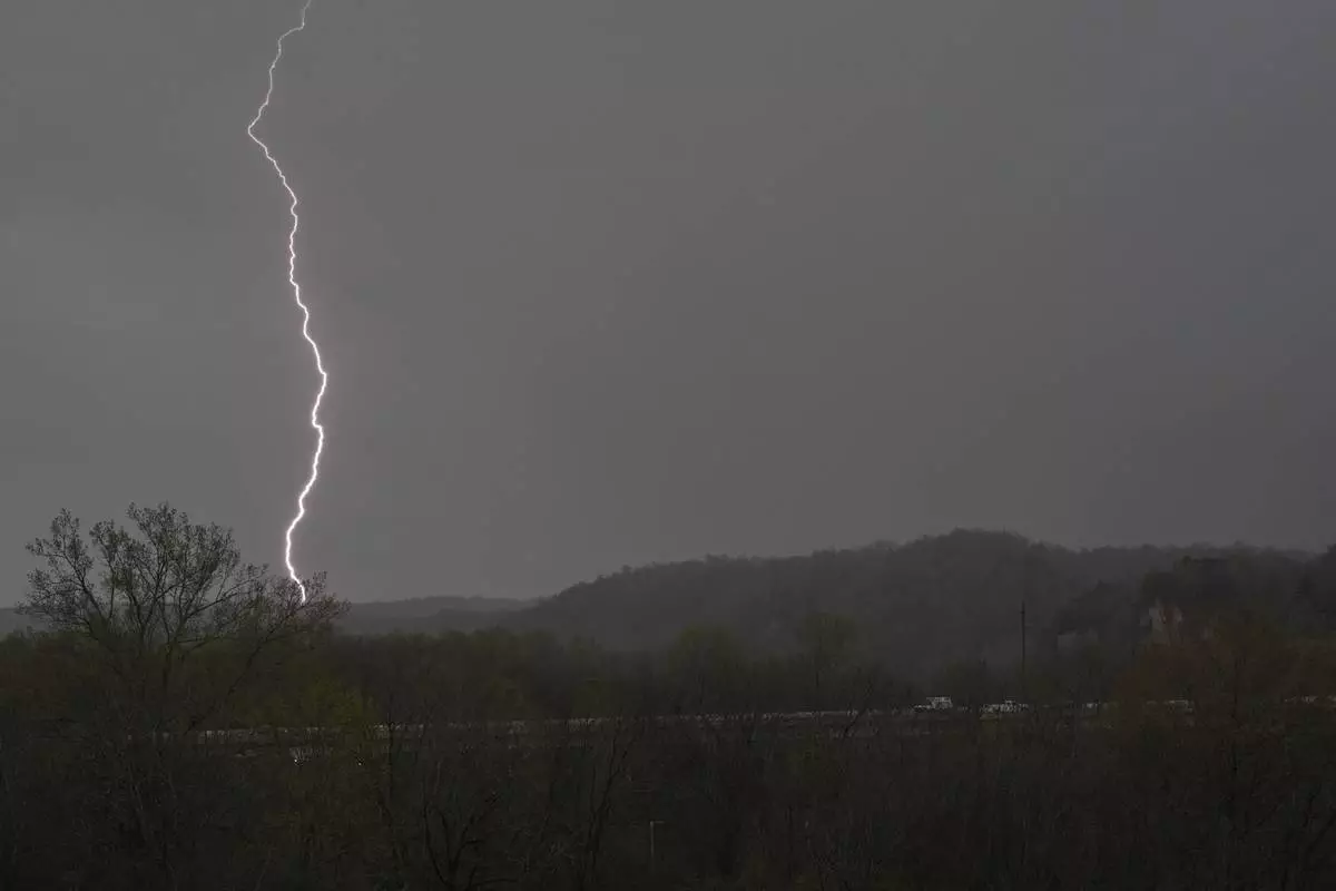
Lightning strikes as storms move through the area Wednesday, April 2, 2025, in Ashland City, Tenn. (AP Photo/George Walker IV)

Lightning strikes as storms move through the area Wednesday, April 2, 2025, in Ashland City, Tenn. (AP Photo/George Walker IV)

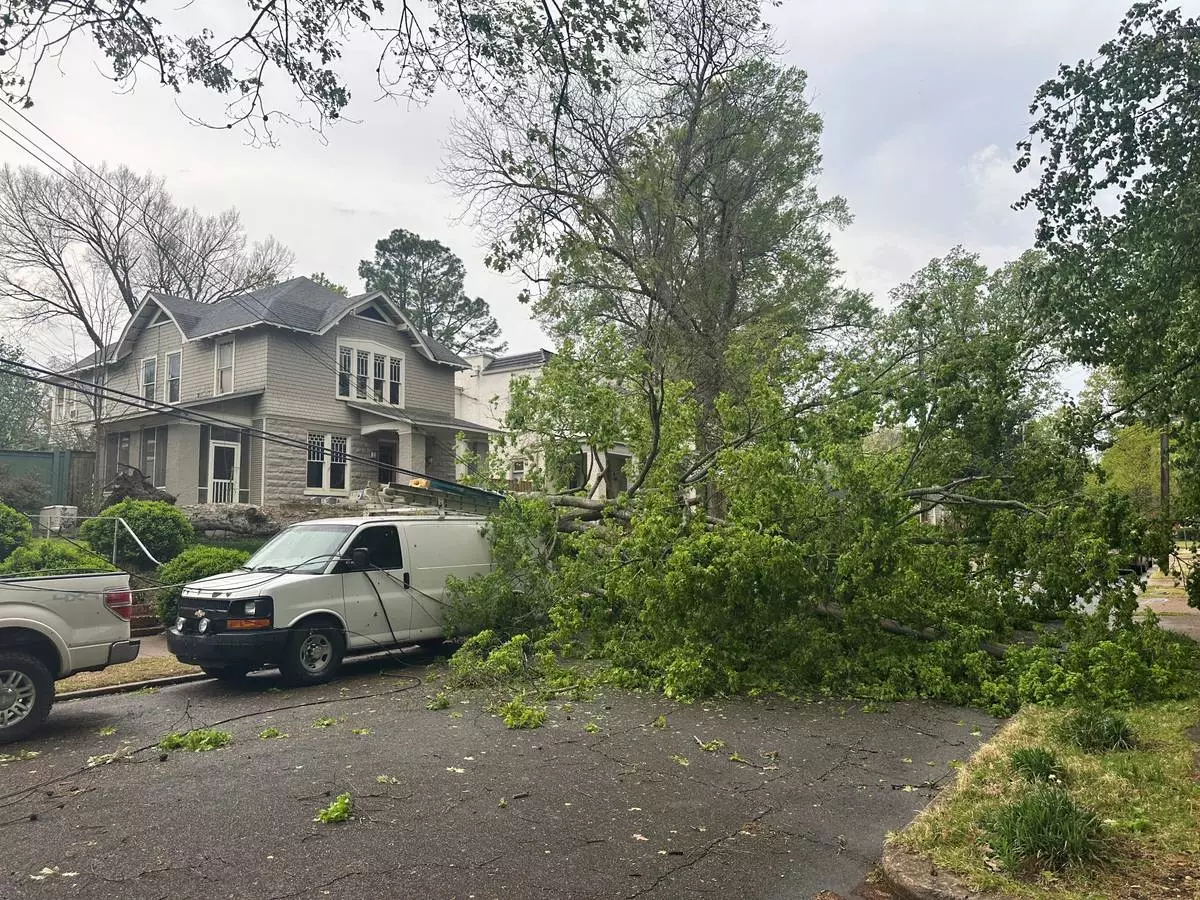
A tree fell and knocked down power lines and blocked a street in a residential neighborhood during storms on Wednesday, April 2, 2025, in Memphis, Tenn. (AP Photo/Adrian Sainz)

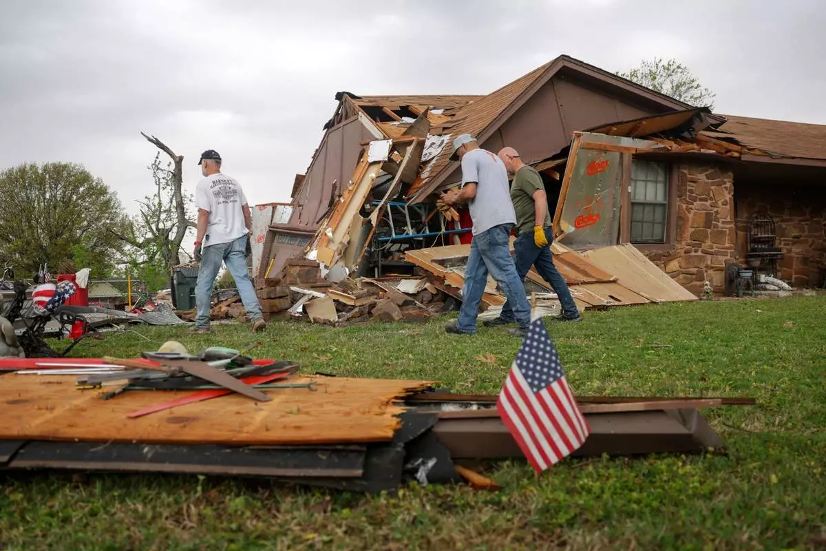
Gary Deripaska, left, cleans up storm damage at his home off 96th Street North just west of Garnett Road, Wednesday, April 2, 2025, in Owasso, Okla. (Mike Simons/Tulsa World via AP)

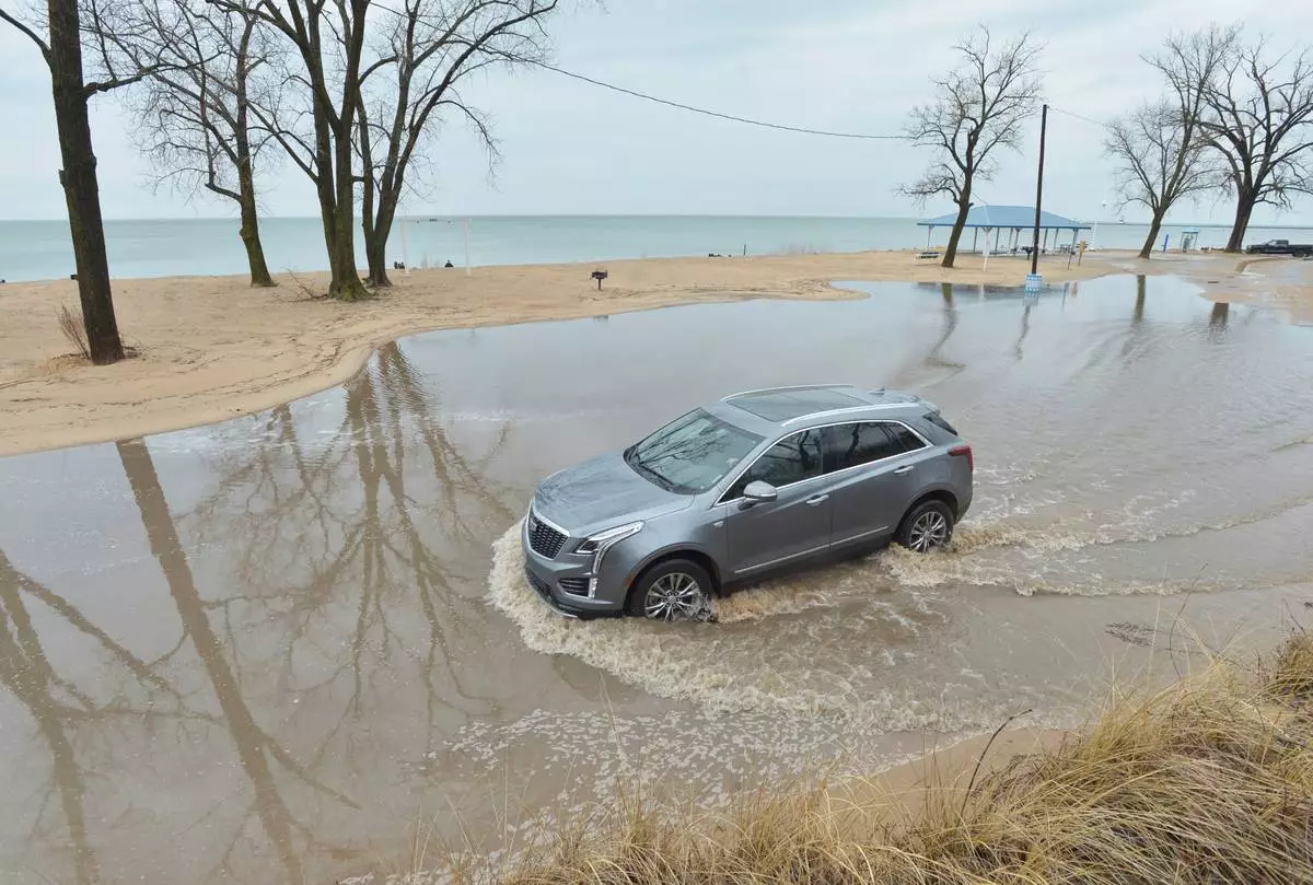
A car drives through a flooded section of road near Lions Park Beach Wednesday, April 2, 2025, in St. Joseph, Mich., after heavy storms moved through Southwest Michigan. (Don Campbell/The Herald-Palladium via AP)

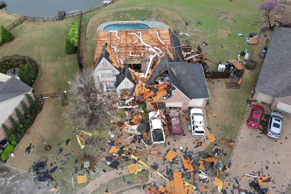
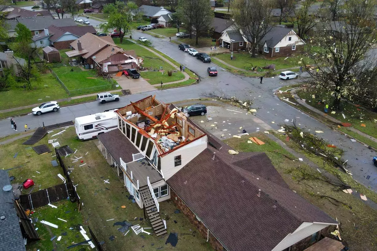
Severe storm damage is shown off 96th Street North between Garnett Road and Mingo Road Wednesday, April 2, 2025, in Owasso, Okla. (Mike Simons/Tulsa World via AP)

An early morning severe storm damaged homes, destroying the roofs and knocked down power lines, trees, and fences off 96th Street North near Garnett Road, Wednesday, April 2, 2025, in Owasso, Okla. (Mike Simons/Tulsa World via AP)

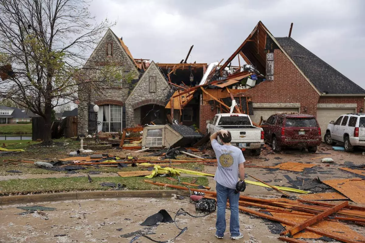
Ryland Mosley, 18, who was on the 2nd story of his home when the storm passed, stands outside of it observing the damage, Wednesday, April 2, 2025 in Owasso, Okla. (Mike Simons/Tulsa World via AP)

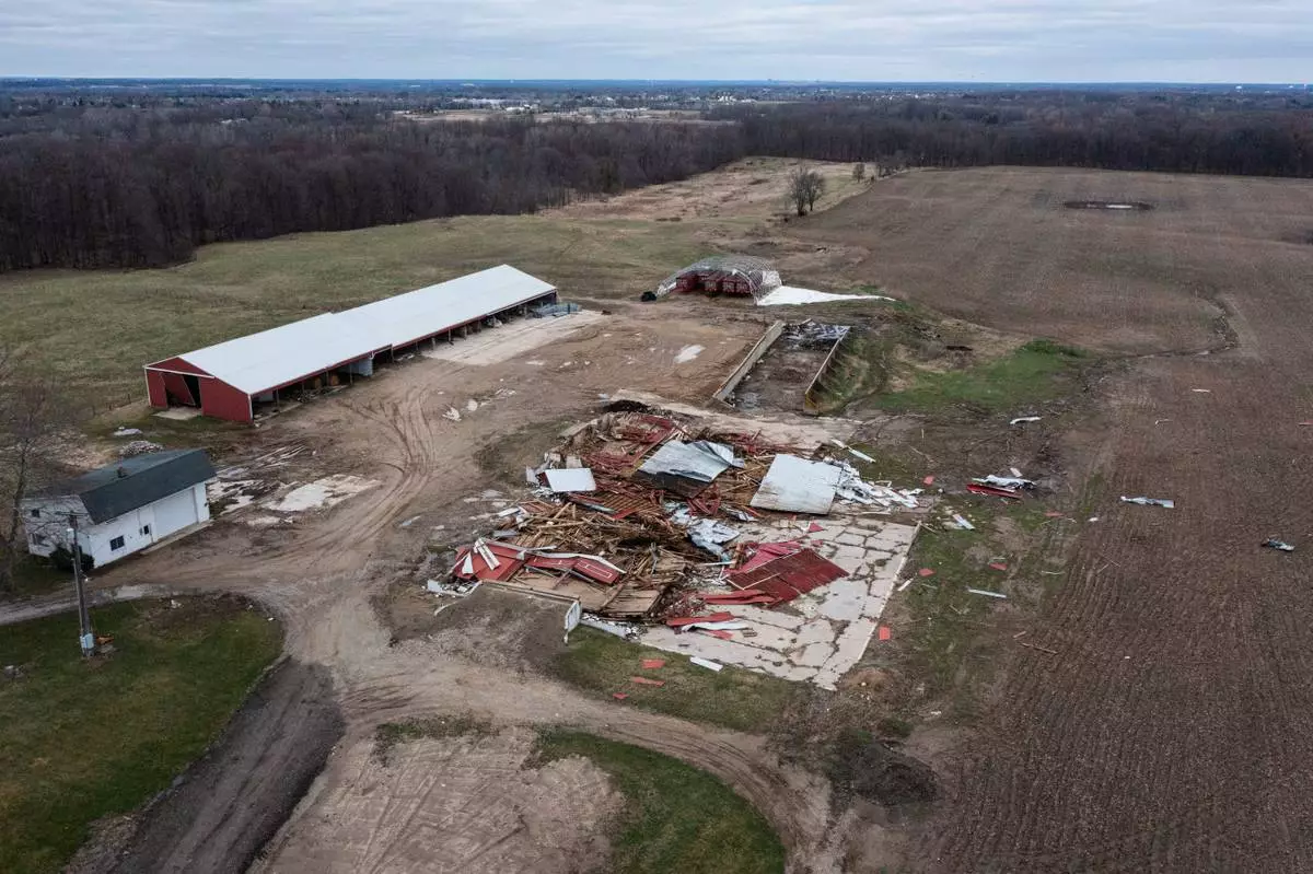
An aerial image of a barn that collapsed after a severe storm hit Sunday along 92nd Street SE in Gaines Twp., Mich., on Monday, March 31, 2025. (Joel Bissell/MLive.com/Kalamazoo Gazette via AP)

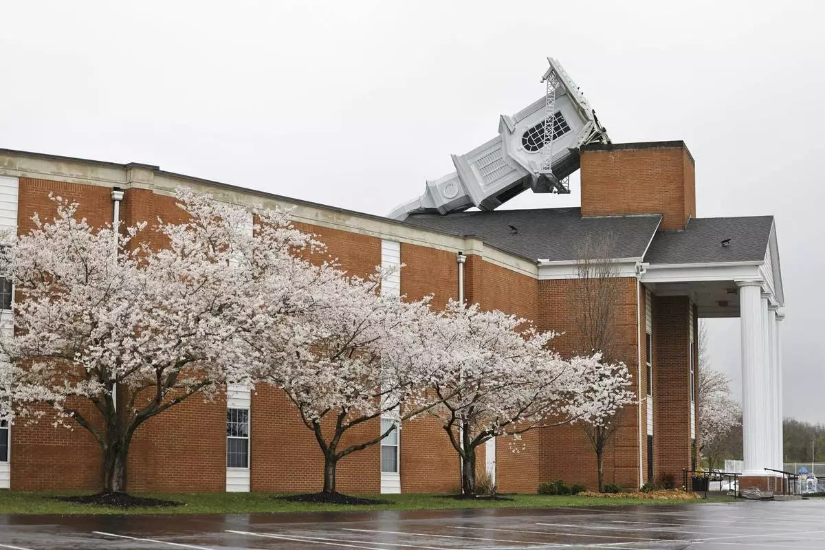
Weekend storms that toppled the steeple at Grace Baptist Church in Franklin, Ohio, is seen Monday, March 31, 2025. (Nick Graham/Dayton Daily News via AP)

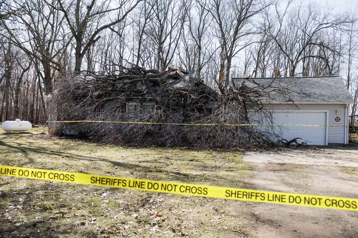
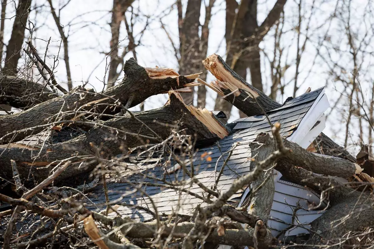
A tree lies on top of a damaged home where authorities say a man was killed during a weekend storm in Stockbridge Township, Mich., seen on Tuesday, April 1, 2025. (Jacob Hamilton/Ann Arbor News via AP)

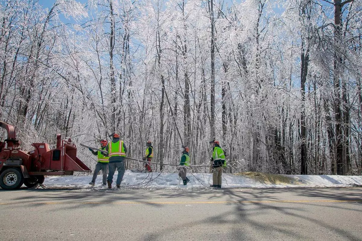
An Antrim County Road Commission crew clears branches and trees hanging near Atwood Road from ice build up Tuesday, April 1, 2025, near Ellsworth, Mich., following weekend storms that deposited as much as one inch of ice over areas of northern lower Michigan. (Jan-Michael Stump/Traverse City Record-Eagle via AP)

Sgt. Tyler Midyett of the Emmet County Sheriff's Department works along with Sgt. Mitch Wallin, not pictured, to clear fallen trees from along Eppler Road in Petoskey, Mich., Tuesday, April 1, 2025, as cleanup from the weekend's ice storm continues. (Jan-Michael Stump/Traverse City Record-Eagle via AP)

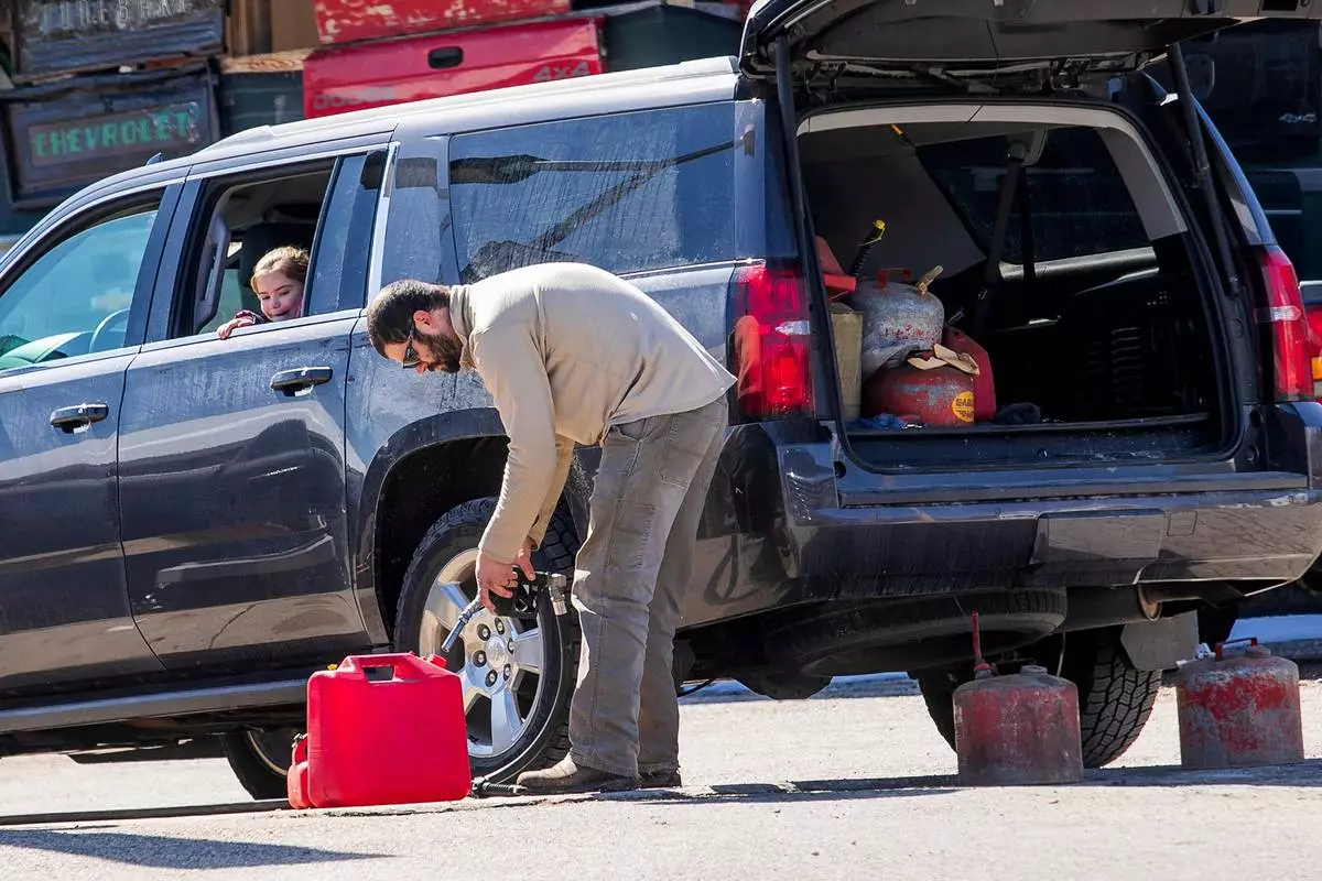
Piper Kuzel, 5, watches her father, Jesse Kuzel of Charlevoix, Mich., fill gas containers at the Ellsworth Farmers Exchange Tuesday, April 1, 2025, in Ellsworth, Mich., as his family has been using heat from their home's natural gas stove to keep warm with power outages widespread following the ice storm. (Jan-Michael Stump/Traverse City Record-Eagle via AP)

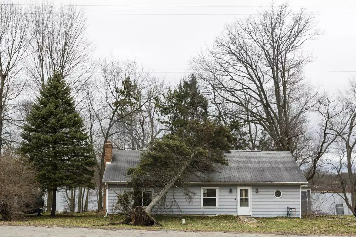
An uprooted tree leans on a home after a severe storm hit Sunday along Clear Lake in Barry County, Mich., on Monday, March 31, 2025. (Joel Bissell/MLive.com/Kalamazoo Gazette via AP)

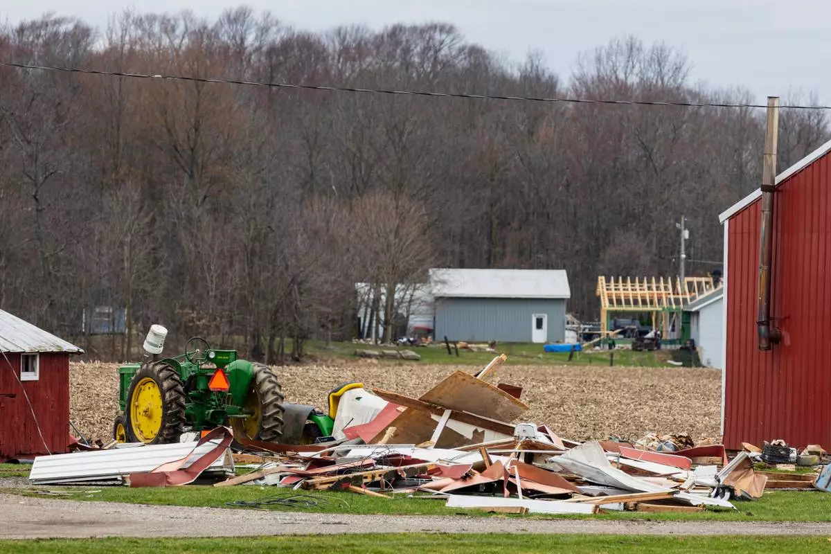
Storm damage from severe weather on Sunday at a farm along 84th Street near Hanna Lake Avenue in Gaines Twp., Mich. on Monday, March 31, 2025. (Joel Bissell/MLive.com/Kalamazoo Gazette via AP)

A barn that collapsed from Sunday's severe storm along 92nd Street SE in Gaines Twp., Mich., on Monday, March 31, 2025. (Joel Bissell/MLive.com/Kalamazoo Gazette via AP)

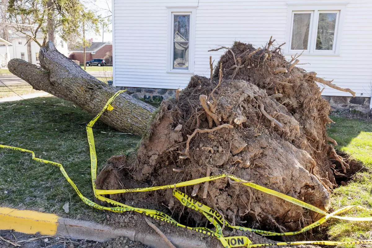
A toppled tree with its roots showing on Woodworth Street in Linden, Mich., on Tuesday, April 1, 2025. (Jacob Hamilton/Ann Arbor News via AP)

A tree lies on top of a damaged home where authorities say a man was killed during a weekend storm in Stockbridge Township, Mich., seen on Tuesday, April 1, 2025. (Jacob Hamilton/Ann Arbor News via AP)


