Coastal regions in east China are bracing for this year's 13th typhoon, Bebinca, which is expected to make landfall in the province during the Mid-Autumn Festival holiday.
Local maritime safety authorities, fishery law enforcement departments in Zhejiang province have been making preparations for the typhoon, which already triggered strong winds on the sea off Taizhou, Zhoushan cities.
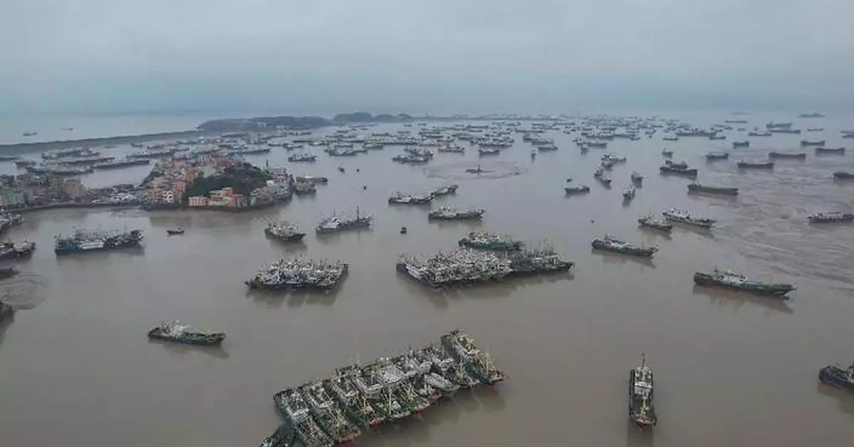
Officials with fishery law enforcement and public security departments in Taizhou's county-level Wenling City checked local ports to ensure all fishing boats are fastened and all residents stay ashore.
In Zhoushan, more than 2,000 merchant ships have sought safety at port. Meanwhile, tank cleaning, fuel supply and other production activities at the port have been suspended.
Zhejiang has halted all water-related construction projects along its coast, evacuated 1,396 workers and suspended all waterborne passenger transport services.
All 602 construction vessels have reached safe waters.
In case of any emergencies, four specialized rescue boats and other maritime emergency response forces have been mobilized.
According to the China Meteorological Administration (CMA), Typhoon Bebinca will move northwestward at about 30 kilometers per hour and gradually increase intensity and make landfall along the coastline from Taizhou, Zhejiang to Qidong, Jiangsu between Sunday night and Monday morning, and gradually weaken afterward.
The NMC issued a yellow typhoon alert, the second lowest level in its four-color weather warning system.
"The most severe impacts are expected to occur shortly before or after the typhoon's landfall on Sunday night. Wave heights may increase rapidly as the typhoon moves at a relatively fast pace, particularly the place where it makes landfall. So it's crucial to take precautions in advance," said Hou Fang from wave forecast division of China's National Marine Environmental Forecasting Center.
Moreover, Typhoon Bebinca's landing will coincide with the arrival of astronomical tide, so winds, tides, and storm surges are very likely to hit the province together.
Some of the coastal areas of Shanghai and Zhejiang are expected to see waves ranging from 4 to 6 meters, while the Yangtze River estuary and the northern coast of Hangzhou Bay in east China may experience a maximum storm surge of 220 centimeters.
The China National Marine Environmental Forecasting Center has issued yellow alert for storm surge, but it could be further upgraded.
"There is still some uncertainty about the Typhoon's path, and if it coincides with the astronomical high tide, we may adjust the warning level to orange or red, accordingly," said Fu Cifu from the storm surge forecast division of China's National Marine Environmental Forecasting Center.
China has a four-tier color-coded weather warning system for storm surge with red representing the most severe, followed by orange, yellow and blue.
Jiangsu province in eastern China activated a level-three emergency response, the second lowest level in its four-tier system, to cope with typhoon from 23:00 on Saturday.
In Shanghai, the local meteorological bureau has upgraded its emergency response against the typhoon to level-three, as strong winds brought by typhoon are forecast to hit the city from Sunday afternoon to Monday morning.
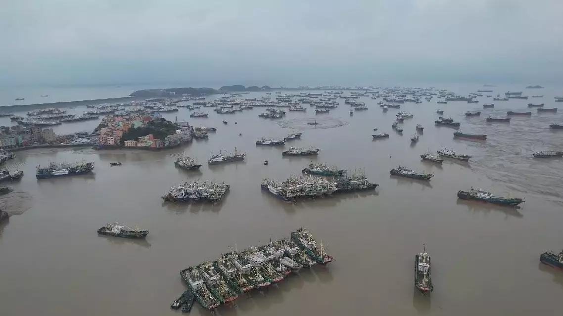
Eastern China braces for Typhoon Bebinca

Eastern China braces for Typhoon Bebinca


